

A | B | C | D | E | F | G | H | CH | I | J | K | L | M | N | O | P | Q | R | S | T | U | V | W | X | Y | Z | 0 | 1 | 2 | 3 | 4 | 5 | 6 | 7 | 8 | 9
Carroll County | |
|---|---|
 | |
 Location within the U.S. state of Illinois | |
 Illinois's location within the U.S. | |
| Coordinates: 42°04′N 89°55′W / 42.06°N 89.92°W | |
| Country | |
| State | |
| Founded | 1839 |
| Named for | Charles Carroll |
| Seat | Mount Carroll |
| Largest city | Savanna |
| Area | |
| • Total | 466 sq mi (1,210 km2) |
| • Land | 445 sq mi (1,150 km2) |
| • Water | 22 sq mi (60 km2) 4.6% |
| Population (2020) | |
| • Total | 15,702 |
| • Estimate (2023) | 15,526 |
| • Density | 34/sq mi (13/km2) |
| Time zone | UTC−6 (Central) |
| • Summer (DST) | UTC−5 (CDT) |
| Congressional district | 17th |
| Website | www |
Carroll County is a county located in the U.S. state of Illinois. As of the 2020 census, the population was 15,702.[1] Its county seat is Mount Carroll.[2]
History
Carroll County was formed in 1839 out of Jo Daviess County. The county is named for Charles Carroll who signed the Declaration of Independence.[3] Carroll, who died in 1832, was the last signer to die.
-
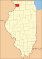 Carroll County at the time of its creation in 1839

Geography
According to the U.S. Census Bureau, the county has a total area of 466 square miles (1,210 km2), of which 445 square miles (1,150 km2) is land and 22 square miles (57 km2) (4.6%) is water.[4] The Mississippi Palisades State Park is in this county, just north of the city of Savanna. The Savanna Army Depot is located partly in this county.
Adjacent counties
- Stephenson County - northeast
- Ogle County - east
- Whiteside County - south
- Clinton County, Iowa - southwest
- Jackson County, Iowa - west
- Jo Daviess County - northwest
National protected area
Major highways
 US Route 52
 Illinois Route 40
 Illinois Route 64
 Illinois Route 72
 Illinois Route 73
 Illinois Route 78
 Illinois Route 84
Climate and weather
| Mount Carroll, Illinois | ||||||||||||||||||||||||||||||||||||||||||||||||||||||||||||
|---|---|---|---|---|---|---|---|---|---|---|---|---|---|---|---|---|---|---|---|---|---|---|---|---|---|---|---|---|---|---|---|---|---|---|---|---|---|---|---|---|---|---|---|---|---|---|---|---|---|---|---|---|---|---|---|---|---|---|---|---|
| Climate chart (explanation) | ||||||||||||||||||||||||||||||||||||||||||||||||||||||||||||
| ||||||||||||||||||||||||||||||||||||||||||||||||||||||||||||
| ||||||||||||||||||||||||||||||||||||||||||||||||||||||||||||
In recent years, average temperatures in the county seat of Mount Carroll have ranged from a low of 7 °F (−14 °C) in January to a high of 85 °F (29 °C) in July, although a record low of −31 °F (−35 °C) was recorded in January 1910 and a record high of 108 °F (42 °C) was recorded in July 1936. Average monthly precipitation ranged from 1.43 inches (36 mm) in January to 4.77 inches (121 mm) in June.[5]
Demographics

| Census | Pop. | Note | %± |
|---|---|---|---|
| 1840 | 1,023 | — | |
| 1850 | 4,586 | 348.3% | |
| 1860 | 11,733 | 155.8% | |
| 1870 | 16,705 | 42.4% | |
| 1880 | 16,976 | 1.6% | |
| 1890 | 18,320 | 7.9% | |
| 1900 | 18,963 | 3.5% | |
| 1910 | 18,035 | −4.9% | |
| 1920 | 19,345 | 7.3% | |
| 1930 | 18,433 | −4.7% | |
| 1940 | 17,987 | −2.4% | |
| 1950 | 18,976 | 5.5% | |
| 1960 | 19,507 | 2.8% | |
| 1970 | 19,276 | −1.2% | |
| 1980 | 18,779 | −2.6% | |
| 1990 | 16,805 | −10.5% | |
| 2000 | 16,674 | −0.8% | |
| 2010 | 15,387 | −7.7% | |
| 2020 | 15,702 | 2.0% | |
| 2023 (est.) | 15,526 | [6] | −1.1% |
| U.S. Decennial Census[7] 1790-1960[8] 1900-1990[9] 1990-2000[10] 2010[11] | |||
As of the 2010 United States Census, there were 15,387 people, 6,622 households, and 4,343 families residing in the county.[12] The population density was 34.6 inhabitants per square mile (13.4/km2). There were 8,437 housing units at an average density of 19.0 per square mile (7.3/km2).[4] The racial makeup of the county was 96.9% white, 0.8% black or African American, 0.3% Asian, 0.3% American Indian, 0.6% from other races, and 1.1% from two or more races. Those of Hispanic or Latino origin made up 2.8% of the population.[12] In terms of ancestry, 40.4% were German, 14.0% were Irish, 11.2% were English, and 10.6% were American.[13]
Of the 6,622 households, 26.3% had children under the age of 18 living with them, 53.1% were married couples living together, 8.2% had a female householder with no husband present, 34.4% were non-families, and 29.8% of all households were made up of individuals. The average household size was 2.29 and the average family size was 2.80. The median age was 46.5 years.[12]
The median income for a household in the county was $44,805 and the median income for a family was $55,341. Males had a median income of $42,421 versus $27,552 for females. The per capita income for the county was $25,914. About 7.8% of families and 11.7% of the population were below the poverty line, including 18.4% of those under age 18 and 5.8% of those age 65 or over.[14]
Education
- Chadwick-Milledgeville Community Unit School District 399
- Eastland Community Unit School District 308
- West Carroll Community Unit School District 314
Communities
| Community |
Community type |
Population | Total Area |
Water Area |
Land Area |
Pop. Density | |
|---|---|---|---|---|---|---|---|
| Chadwick | village | 481 | 0.31 | 0.00 | 0.31 | 1,546.62 | |
| Lanark | city | 1,504 | 1.12 | 0.00 | 1.12 | 1,341.66 | |
| Milledgeville | village | 1,026 | 0.69 | 0.00 | 0.69 | 1,486.96 | |
| Mount Carroll (seat) | city | 1,479 | 2.00 | 0.00 | 2.00 | 738.39 | |
| Savanna | city | 2,783 | 2.71 | 0.09 | 2.62 | 1,063.84 | |
| Shannon | village | 801 | 0.48 | 0.00 | 0.48 | 1,661.83 | |
| Thomson | village | 1,610 | 2.22 | 0.00 | 2.22 | 725.55 | |
| Carroll County | county | 15,702 | 466 | 22 | 445 | 34 |
Townships
Carroll County is divided into these twelve townships:
- Cherry Grove-Shannon
- Elkhorn Grove
- Fairhaven
- Freedom
- Mount Carroll
- Rock Creek-Lima
- Salem
- Savanna
- Washington
- Woodland
- Wysox
- York
Census designated place
Unincorporated Communities
Notable people
- John Acker, Illinois state representative, was born on a farm near Savanna.[15]
- Willis J. Bailey, United States Representative from Kansas and the 16th Governor of Kansas[16]
- Neva Burright, Illinois harness racing driver and first woman to win a Grand Circuit race
- David J. Summerville, Wisconsin State Assemblyman[17]
Politics
| Year | Republican | Democratic | Third party | |||
|---|---|---|---|---|---|---|
| No. | % | No. | % | No. | % | |
| 2020 | 5,105 | 63.52% | 2,748 | 34.19% | 184 | 2.29% |
| 2016 | 4,434 | 59.56% | 2,447 | 32.87% | 564 | 7.58% |
| 2012 | 3,555 | 48.00% | 3,665 | 49.49% | 186 | 2.51% |
| 2008 | 3,596 | 46.74% | 3,965 | 51.54% | 132 | 1.72% |
| 2004 | 4,534 | 55.73% | 3,537 | 43.48% | 64 | 0.79% |
| 2000 | 3,835 | 53.43% | 3,113 | 43.37% | 229 | 3.19% |
| 1996 | 3,029 | 44.55% | 2,926 | 43.04% | 844 | 12.41% |
| 1992 | 3,297 | 42.94% | 2,854 | 37.17% | 1,528 | 19.90% |
| 1988 | 4,464 | 59.42% | 2,990 | 39.80% | 58 | 0.77% |