A | B | C | D | E | F | G | H | CH | I | J | K | L | M | N | O | P | Q | R | S | T | U | V | W | X | Y | Z | 0 | 1 | 2 | 3 | 4 | 5 | 6 | 7 | 8 | 9
Lào Cai province
Tỉnh Lào Cai | |
|---|---|
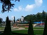
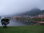
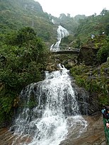
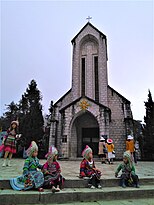
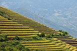
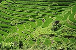
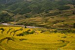
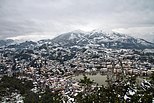
Fansipan aerial tramway • Phan Xi Păng • Topas tourist area • Bảo An Temple • Lào Cai Mountain • Lào Cai City • Hoàng A Tưởng House • Sa Pa Terrace • Sa Pa Mountain • Stone church in Sa Pa • Bạc Waterfall • snowfall at Sa Pa | |
 Location of Lào Cai within Vietnam | |
 | |
| Coordinates: 22°20′N 104°0′E / 22.333°N 104.000°E | |
| Country | |
| Region | Northwest |
| Capital | Lào Cai |
| Subdivision | 1 city, 7 rural districts and one town |
| Government | |
| • Type | Province |
| • Body | Lào Cai Provincial People's Council |
| • Chairman of People's Council | Nguyễn Văn Vịnh |
| • Chairman of People's Committee | Trịnh Xuân Trường |
| Area | |
| • Province | 6,364.25 km2 (2,457.25 sq mi) |
| Population (2023)[2] | |
| • Province | 781,103 |
| • Density | 120/km2 (320/sq mi) |
| • Urban | 181,019 |
| Ethnic groups | |
| • Vietnamese[3] | 33.78% |
| • Mông | 25.08% |
| • Tày | 14.83% |
| • Dao | 14.24% |
| • Giáy | 4.53% |
| • Others | 7.54% |
| GDP[4] | |
| • Province | VND 43.634 trillion US$ 1.895 billion |
| Time zone | UTC+7 (ICT) |
| Postal code | 31xxx |
| Area codes | 214 |
| ISO 3166 code | VN-02 |
| Website | www |
Lào Cai ([laːw˨˩ kaːj˧˧] ) is a province of the mountainous Northwest region of Vietnam bordering the province of Yunnan in China.[5] The province covers an area of about 6,364 km2 (2,457 sq mi)[1] and as of 2023 it had a population of 781,103 people. With 181,019 people living in urban areas and 562,382 living in rural areas.[6]
Lào Cai and Sa Pa are two important cities within the province at the border with China; the former is well known as key trading post and the latter is hill station famous for tourism, in the Northwest region of Vietnam. Lào Cai is also the capital of Lào Cai province and shares border with the city of Hekou, in the Yunnan province of Southwest China. This border town was closed after the 1979 war with China, since reopened in 1993, has become a major tourist centre between Hanoi, Sa Pa and Kunming (China). Sa Pa is notable as a hill resort and market centre for the local ethnic Hmong, including the Red, Black, Green and Flower Hmong. Located across the Muong Hoa Valley from Vietnam's highest mountain, Fansipan, the city is sometimes referred to as the "queen of mountains".[5][7][8]
Lào Cai has many historical sites, natural caves and produces agricultural specialties such as Bắc Hà plums.
In a 1929 survey conducted in the area, the vegetation (flora) and fauna (mammals) recorded by the French biologist Delacour who accompanied Theodore Roosevelt were unique to the region in northern Vietnam.[9]
Etymology
The name "Lao-Kay" has been used by the French since the colonial era in their writing, pronounced as "Lào Cai" by the Vietnamese. The latter became official usage and spelling after November 1950.[10]
The origin of the province's name is unclear and there are several explanations. The area in the ward of Cốc Lếu was the site of an old commercial district that developed into a market town. Because of this it was called Lão Nhai (老街, literally Phố Cũ, Old Town), in Hmong language it is pronounced as "Lao Cai". After this a new market town was developed and named Tân Nhai (新街, today Phố Mới, New Town). The word Lào Cai is sourced to "Lao Kai" which appeared as Jean Dupuis led a naval expedition up the Red River and in 1879 published the Map of Tonkin, in which the location was marked as "Lao-kai, residence du Chef des Pavillone noirs" (residence of the Head of Black Flag Army).[11] According to Professor Đào Duy Anh, it derives from the word "Lão Nhai". While making maps, the French wrote it as "Lao-Kay" and this word was used by them in documents. When reading, the Vietnamese pronounced it Lào Cai and this has persisted since.[10]
Geography and climate

Lào Cai province is located in the north of the country and has an area of 6,364.25 km2 (2,457.25 sq mi).[1] It borders the provinces of Hà Giang, Yên Bái, and Lai Châu, as well as the province of Yunnan in the People's Republic of China.[12]
There are ten major soil groups under 30 categories in the province, under ten land groups. The land groups are: The Alluvial group (1.47% of the land area) along the Red River is good for growing food crops and trees; the Oxisol type which occupies 40% of land area has generally reddish brown soil, below altitude of 900 metres (3,000 ft), is a fertile land suitable for the annual and commercial crops; Team Red Yellow soil humus covers 30% land area in the Sa Pa, Mường Khương, Bắc Hà, Bát Xát districts of the province suitable for medicinal plants, fruit trees and vegetables; humus soil on the mountain occupies 11.42% of the land area mostly in Sa Pa district which has rich canopy of mixed forest; and the Oxisol color altered by rice in 2% of land area are formed into a landscape of terraced fields, as seen in Bắc Hà and Sa Pa districts.[13]
- Climate
As the province is mostly mountainous, it experiences a dry cold climate from October to March, while the tropical monsoon is rainy season, which lasts from April to September. The annual average temperature is 23 °C (73 °F). The temperature generally ranges between 18 °C (64 °F) and 28 °C (82 °F) in the lowland areas and between 20 °C (68 °F) and 22 °C (72 °F) in the highland areas. In Sa Pa town, however, the temperature can drop to less than 0 °C (32 °F) with snowy conditions. Fog and frost are a common phenomenon in the province.[5][12]
| Climate data for Lào Cai | |||||||||||||
|---|---|---|---|---|---|---|---|---|---|---|---|---|---|
| Month | Jan | Feb | Mar | Apr | May | Jun | Jul | Aug | Sep | Oct | Nov | Dec | Year |
| Record high °C (°F) | 31.4 (88.5) |
34.6 (94.3) |
38.0 (100.4) |
39.0 (102.2) |
42.8 (109.0) |
40.1 (104.2) |
39.7 (103.5) |
40.0 (104.0) |
36.8 (98.2) |
37.2 (99.0) |
33.2 (91.8) |
32.8 (91.0) |
42.8 (109.0) |
| Mean daily maximum °C (°F) | 20.1 (68.2) |
21.3 (70.3) |
25.3 (77.5) |
28.8 (83.8) |
32.1 (89.8) |
32.7 (90.9) |
32.7 (90.9) |
32.4 (90.3) |
31.3 (88.3) |
28.7 (83.7) |
25.1 (77.2) |
21.9 (71.4) |
27.7 (81.9) |
| Daily mean °C (°F) | 15.7 (60.3) |
17.0 (62.6) |
20.7 (69.3) |
24.2 (75.6) |
27.0 (80.6) |
27.9 (82.2) |
27.9 (82.2) |
27.5 (81.5) |
26.3 (79.3) |
24.0 (75.2) |
20.2 (68.4) |
17.0 (62.6) |
23.0 (73.4) |
| Mean daily minimum °C (°F) | 13.3 (55.9) |
14.5 (58.1) |
17.9 (64.2) |
21.1 (70.0) |
23.6 (74.5) |
24.7 (76.5) |
24.9 (76.8) |
24.4 (75.9) |
23.3 (73.9) |
21.2 (70.2) |
17.5 (63.5) |
14.3 (57.7) |
20.0 (68.0) |
| Record low °C (°F) | 1.4 (34.5) |
5.6 (42.1) |
6.8 (44.2) |
10.0 (50.0) |
14.8 (58.6) |
18.7 (65.7) |
20.0 (68.0) |
17.3 (63.1) |
15.8 (60.4) |
8.8 (47.8) |
5.8 (42.4) |
2.8 (37.0) |
1.4 (34.5) |
| Average precipitation mm (inches) | 22 (0.9) |
33 (1.3) |
58 (2.3) |
129 (5.1) |
171 (6.7) |
239 (9.4) |
302 (11.9) |
355 (14.0) |
222 (8.7) |
153 (6.0) |
54 (2.1) |
27 (1.1) |
1,764 (69.4) |
| Average rainy days | 7.8 | 8.8 | 11.5 | 15.8 | 16.8 | 18.7 | 20.9 | 21.1 | 15.8 | 14.8 | 10.2 | 7.7 | 169.8 |
| Average relative humidity (%) | 84.8 | 84.0 | 82.5 | 83.1 | 81.4 | 84.4 | 85.8 | 86.0 | 85.5 | 85.8 | 86.3 | 85.8 | 84.6 |
| Mean monthly sunshine hours | 80.4 | 76.9 | 105.0 | 144.9 | 189.2 | 148.9 | 166.6 | 168.1 | 162.5 | 129.9 | 105.4 | 110.6 | 1,588.4 |
| Source 1: Vietnam Institute for Building Science and Technology[14] | |||||||||||||
| Source 2: The Yearbook of Indochina [15] | |||||||||||||
| Climate data for Sa Pa | |||||||||||||
|---|---|---|---|---|---|---|---|---|---|---|---|---|---|
| Month | Jan | Feb | Mar | Apr | May | Jun | Jul | Aug | Sep | Oct | Nov | Dec | Year |
| Record high °C (°F) | 23.2 (73.8) |
25.8 (78.4) |
28.1 (82.6) |
29.8 (85.6) |
30.0 (86.0) |
29.4 (84.9) |
29.1 (84.4) |
29.6 (85.3) |
28.2 (82.8) |
26.4 (79.5) |
24.5 (76.1) |
24.0 (75.2) |
30.0 (86.0) |
| Mean daily maximum °C (°F) | 12.3 (54.1) |
14.3 (57.7) |
18.2 (64.8) |
21.3 (70.3) |
22.4 (72.3) |
22.9 (73.2) |
23.0 (73.4) |
23.0 (73.4) |
21.7 (71.1) |
19.0 (66.2) |
16.1 (61.0) |
13.2 (55.8) |
18.9 (66.0) |
| Daily mean °C (°F) | 8.6 (47.5) |
10.4 (50.7) |
13.9 (57.0) |
17.1 (62.8) |
18.9 (66.0) |
19.8 (67.6) |
19.8 (67.6) |
19.5 (67.1) |
18.2 (64.8) |
15.7 (60.3) |
12.5 (54.5) |
9.4 (48.9) |
15.3 (59.5) |
| Mean daily minimum °C (°F) | 6.2 (43.2) |
7.8 (46.0) |
10.8 (51.4) |
14.0 (57.2) |
16.3 (61.3) |
17.6 (63.7) |
17.7 (63.9) |
17.4 (63.3) |
15.9 (60.6) |
13.7 (56.7) |
10.2 (50.4) |
7.0 (44.6) |
12.9 (55.2) |
| Record low °C (°F) | −6.1 (21.0) |
−1.3 (29.7) |
−3.5 (25.7) |
3.4 (38.1) |
8.3 (46.9) |
10.8 (51.4) |
7.0 (44.6) |
10.4 (50.7) |
8.7 (47.7) |
5.6 (42.1) |
1.0 (33.8) |
−3.2 (26.2) |
−6.1 (21.0) |
| Average precipitation mm (inches) | 70.2 (2.76) |
73.5 (2.89) |
104.5 (4.11) |
213.4 (8.40) |
340.6 (13.41) |
381.4 (15.02) |
461.0 (18.15) |
451.9 (17.79) |
303.1 (11.93) |
201.3 (7.93) |
106.3 (4.19) |
65.7 (2.59) |
2,779.6 (109.43) |
| Average rainy days | 16.3 | 16.3 | 15.7 | 17.9 | 22.2 | 24.4 | 25.6 | 23.4 | 19.8 | 18.6 | 13.8 | 13.5 | 228.1 |
| Average relative humidity (%) | 87.8 | 85.5 | 82.1 | 82.3 | 84.8 | 86.9 | 88.3 | 88.8 | 90.0 | 90.8 | 80.5 | 80.3 | 87.2 |
| Mean monthly sunshine hours | 113.3 | 115.6 | 151.2 | 167.8 | 148.1 | 98.9 | 104.1 | 114.2 | 101.7 | 94.0 | 112.5 | 121.0 | 1,435.9 |
| Source 1: Vietnam Institute for Building Science and Technology[16] | |||||||||||||
| Source 2: The Yearbook of Indochina[17] | |||||||||||||
- Water resources
Lào Cai is a mountainous region. In the northwest of the province is Phan Xi Păng (also called Fansipan; elevation 3,143 metres (10,312 ft), snow covered during winter season), Vietnam's highest mountain. It is located in the Hoàng Liên Sơn and the Hoàng Liên National Park. The Sa Pa Mountains form the western part of the province. While the province is drained by over 100 rivers, the main river that bisects the province is the Red River, (Vietnamese: Sông Hồng), the most significant river of northern Vietnam, which flows out of China towards the capital Hanoi. It flows through the province over a length of 130 kilometres (81 mi). Other rivers of significance are the Chay and Nam Ti Rivers. Much of the province is heavily forested.[12]
Ground water resources have been estimated reserves as 4,448 million cubic metres out of which good quality water is estimated as 30 million cubic metres. In addition, there are four mineral water sources.[13]
- Mineral resources
The province has rich mineral resources, 30 types have been identified with good reserves. The major valuable mineral reserves are: Copper (53 million tons), molybdenum (15 million tons), apatite and iron (2.5 billion tons). There are 150 mines in the province exploiting various minerals.[13]
Flora and fauna
Forests account for 2,789.07 kilometres (1,733.05 mi), accounting for 43.87% of the province's area, of which 2,292.97 kilometres (1,424.79 mi) is natural while the remainder is plantation forestry. The forests feature 442 species, including various types of birds, insects and frogs. The province has a rich forest reserve known for its many species of rare timber plants; some of the well known species are: po mu (fukiena), lat hoa (chukrasia tabularis), and cho chi, apart from many species of medicinal herbs.[5]
In the Fansipan mountain ranges, vegetation varies with altitude, with elevation above 1,500 metres (4,900 ft) retaining the forests. In the elevation range of 2,500–2,800 metres (8,200–9,200 ft), which is the mist area, "elfin forest" is the dominant forest vegetation of "gnarled trees (Tsuga yunanaris)" of less than 8 metres (26 ft) height covered with moss. Above 2,800 metres (9,200 ft) elevation, the mountain range has undersized vegetation with many bamboos and rhododendrons.[9]
The Hoang Lien National Park has only 12 square kilometres (4.6 sq mi) of forest left as a result of anthropogenic pressure over centuries. Grass, bushes and small trees are seen on the land which are devoid of forests, and large areas are used for cultivation; ginger plantation, as a cash crop is widespread.[9]
According to a 1929 survey conducted in the area, the fauna (mammals) recorded by the French biologist Delacour who accompanied Theodore Roosevelt were: the clouded leopard (Neofelis nebuiosa), leopard (Panthera pardus), tiger (panthera tigris), binturong (Arctictus binturong) and black gibbon (Hylobates concolor), the stump-tailed macaque (Macaca arctoides), and Asiatic black bear (Selenarctos thibetanus). In Sa Pa forests, 150 species of birds were recorded such as the red-vented barbet ( Megalaima lagrandieri), collared finchbill (Spizixo semitoroues), white-throated laughingthrush (Garrulax albogularis) and the chestnut bulbul (Hypsipetes castanotus); all species are considered exclusive to North Vietnam.[9]
History


Lào Cai has been known since ancient times as a historic trading post. Here, the Chinese, the Vietnamese and the ethnic minorities of the region fought to gain control of the region. In 1463, the Viet Kings established Lào Cai as the capital of their northernmost region, then named as Hưng Hóa. It came under French colonial rule in 1889 and was their administrative town, and also served as a military garrison. In the early 19th century the first railway line was built from Hanoi to this region. It took seven years to complete but at the cost of 25,000 lives of Vietnamese conscripted labour.[18]
In late 1978, the Vietnamese invaded Cambodia. In retaliation, the Chinese, as allies of Cambodia, countered and invaded North Vietnam with the aim of "teaching the Vietnamese a lesson". The attack was launched by 200,000 strong People's Liberation Army. They occupied territory from Paso (previously known as Phon Tho) in the Northwest to Cao Bằng and Lạng Sơn in the Northwest. Even though the Chinese suffered heavy casualties, they managed to conquer these cities, and declared that the gate to Hanoi was open and that their punitive mission had been achieved. On the way back to the Chinese border, the PLA destroyed all local infrastructure and housing and looted all useful equipment and resources (including livestock), which were mainly donated by China to support Vietnam's economy prior to the war, severely weakening the economy of Vietnam's northernmost provinces. The PLA crossed the border back into China on March 16. Both sides declared victory with China claiming to have crushed the Vietnamese resistance and Vietnam claiming that China had fought mostly against border militias.
After the province was invaded by the Chinese in 1979 from its border town Lào Cai, the border with China was closed for several years. In this war, the city of Lào Cai was destroyed by the Chinese. Remnants of the war in the form of land mines are reported to pose threat to people along the border with China.[19][20]
The Lào Cai town at the border town on the bank of Red River as the provincial capital has now prospered in view of large trade with China and is a booming city with a community of many rich millionaires. Since 2006, Lào Cai has the status of a city, is the largest town in the region and strategically very important. An airport is planned to be built by 2020.[18][21]
Administrative divisions
Lào Cai is subdivided into 9 district-level sub-divisions:


