
A | B | C | D | E | F | G | H | CH | I | J | K | L | M | N | O | P | Q | R | S | T | U | V | W | X | Y | Z | 0 | 1 | 2 | 3 | 4 | 5 | 6 | 7 | 8 | 9
This article is missing information about World Heritage Sites inscribed in 2021. (March 2022) |
No sites or not in Western Europe
- 1-10 sites
- 11-20 sites
- 21-30 sites
- 31+ sites
The United Nations Educational, Scientific and Cultural Organization (UNESCO) has designated 171 World Heritage Sites in Western Europe (including international dependencies). These sites are located in 9 countries (also called "state parties"); Germany and France are home to the most with 46 and 45, while Liechtenstein, Monaco and the British Crown Dependencies of the Isle of Man, Guernsey and Jersey have no sites. There are twelve sites which are shared between state parties both in and out of Western Europe.[1][2] The first site from the region to be included on the list was the Aachen Cathedral in Germany in 1978, the year of the list's conception.[3]
Each year, UNESCO's World Heritage Committee may inscribe new sites on the list, or delist sites that no longer meet the criteria. Selection is based on ten criteria: six for cultural heritage (i–vi) and four for natural heritage (vii–x).[4] Some sites, designated "mixed sites," represent both cultural and natural heritage.[5] In Western Europe, there are 151 cultural, 18 natural, and 2 mixed sites.[5]
The World Heritage Committee may also specify that a site is endangered, citing "conditions which threaten the very characteristics for which a property was inscribed on the World Heritage List."[6] Presently, none of the sites in Western Europe are currently listed as endangered, though two German sites and an English site were previously listed: the Cologne Cathedral was marked as endangered in 2004 due to the construction of several high-rise buildings around it, but it was removed from the list in 2006.[7] The Dresden Elbe Valley site was listed in 2006 in hopes of halting the construction of the four lane Waldschlösschen Bridge through the valley.[6][8][9] When construction continued as planned, it became the second site to be delisted as a World Heritage in 2009, the first being Oman's Arabian Oryx Sanctuary two years earlier.[10] Liverpool Maritime Mercantile City was listed in 2004, marked as endangered in 2012 due to planned developments in the protected area, and removed from the list in 2021 when development plans went ahead.[11]
List
Legend
The list below uses a cultural definition of Western Europe (which includes Ireland and the United Kingdom, contrary to the United Nations Statistics Division's definition). It also omits eight sites outside of Europe belonging to European state parties: Curaçao (Netherlands), French Austral Lands and Seas (France), French Polynesia (France), New Caledonia (France), Reunion Island (France), Gough Island (United Kingdom), Henderson Island (United Kingdom), and Bermuda (United Kingdom). These sites are included in the African, American, and Oceania lists.
- Site – named after the World Heritage Committee's official designation[5]
- Location – sorted by country, followed by the region at the regional or provincial level and geocoordinates. In the case of multinational or multi-regional sites, the names are sorted alphabetically.
- Criteria – as defined by the World Heritage Committee[4]
- Area – in hectares and acres, followed by buffer zones if applicable. A value of zero implies that no data has been published by UNESCO
- Year – during which the site was inscribed to the World Heritage List
- Description – brief information about the site, including reasons for qualifying as an endangered site, if applicable
World Heritage Sites
| Site | Image | Location | Criteria | Area ha (acre) |
Year | Description |
|---|---|---|---|---|---|---|
| Aachen Cathedral | 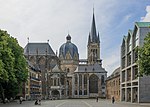 |
Aachen, 50°46′28″N 6°5′4″E / 50.77444°N 6.08444°E |
Cultural: (i), (ii), (iv), (vi) |
0.2 (0.49) | 1978 | An iconic feat of architecture that sparked copies around Germany for centuries to come, Aachen's cathedral became the first-built vaulted structure since antiquity. The town itself was closely tied to Charlemagne during the cathedral's inception, which explains why it became his burial place when he died in 814.[12] |
| Abbey and Altenmünster of Lorsch |  |
Lorsch, 49°39′13″N 8°34′7″E / 49.65361°N 8.56861°E |
Cultural: (iii), (iv) |
3.34 (8.3) | 1991 | The abbey and gate or 'Torhall', are from the Carolingian era. The notable Carolingian sculptures and paintings are still in good condition.[13] |
| Abbey Church of Saint-Savin sur Gartempe |  |
Vienne, 46°33′53″N 0°51′58″E / 46.56472°N 0.86611°E |
Cultural: (i), (iii) |
1.61 (4.0) | 1983 | Often referred to as the "Romanesque Sistine Chapel", the church features well-preserved murals from the 11th and 12th centuries.[14] |
| Amiens Cathedral |  |
Amiens, 49°53′42″N 2°18′6″E / 49.89500°N 2.30167°E |
Cultural: (i), (ii) |
1.54 (3.8) | 1981 | Amiens Cathedral is known as one of the classic Gothic churches of the 13th century. Following a devastating fire in 1218, it spent almost an entire 200 years under construction before taking on its current form in 1401, after which it has remained in great shape.[15] |
| Ancient and Primeval Beech Forests of the Carpathians and Other Regions of Europe |  |
49°5′10″N 22°32′10″E / 49.08611°N 22.53611°E |
Natural: (ix) |
92,023 (227,390); buffer zone 253,815 (627,190) | 2007[nb 1] | Primeval Beech Forests of the Carpathians are used to study the spread of the beech tree (Fagus sylvatica) in the Northern Hemisphere across a variety of environments and the environment in the forest. The addition of the Ancient Beech Forests of Germany in 2011 included five forests totaling 4,391 hectares (10,850 acres) that are added to the 29,278 hectares (72,350 acres) of Slovakian and Ukrainian beech forests inscribed on the World Heritage List in 2007. The site was further expanded in 2017 to include forests in 9 additional European countries.[16] |
| Archaeological Border complex of Hedeby and the Danevirke |  |
Schleswig, Schleswig-Holstein, 54°29′28″N 9°33′55″E / 54.49111°N 9.56528°E |
Cultural: (iii), (iv) |
227.55 (562.3) | 2018 | Hedeby was an important settlement of Danish Vikings and Swedish Varangians. It is considered an early medieval city in northern Europe and was an important trading place and main hub for long-distance trade between Scandinavia, western Europe, the North Sea region and the Baltic States.
The Danevirke is a fortification of the early and high Middle Ages in northern Schleswig-Holstein, Germany. It consists of earth walls with moats, a brick wall, two medieval wall castles and a sea barrier.[17] |
| Brú na Bóinne - Archaeological Ensemble of the Bend of the Boyne |  |
County Meath, 53°41′30.012″N 6°27′0″W / 53.69167000°N 6.45000°W |
Cultural: (i), (iii), (iv) |
770 (1,900) | 1993 | The site is a unique testament to the longevity of several prehistoric and medieval settlements, featuring various cultural, artistic and scientific advancements that span four millennia.[18] |
| The Architectural Work of Le Corbusier, an Outstanding Contribution to the Modern Movement |  |
46°28′06″N 6°49′46″E / 46.46833°N 6.82944°E |
Cultural: (i), (ii), (vi) |
98 (240) | 2016 | Seventeen examples in seven countries of the work of modern architecture pioneer Le Corbusier. These buildings span about half a century of work and illustrate the solutions that modern architects found to meet the needs of society as well as the international reach of modern architecture.[19] |
| Arles, Roman and Romanesque Monuments |  |
Bouches-du-Rhône, 43°40′40″N 4°37′51″E / 43.67778°N 4.63083°E |
Cultural: (ii), (iv) |
65 (160) | 1981 | The city, originally built in the 6th century BCE by Phocaean settlers from Greece, was remodelled by the Romans and slowly grew into an important metropolis, both politically and religiously. By 480, however, Arles was conquered by Barbarians and suffered a decline in its status until the 9th century, when Boso founded what would later become the Kingdom of Burgundy-Arles, where it regained its importance.[20] |
| Bauhaus and its Sites in Weimar, Dessau and Bernau |  |
Weimar, Dessau and Bernau 50°58′29″N 11°19′46″E / 50.97472°N 11.32944°E |
Cultural: (ii), (iv), (vi) |
8.16 (20.2); buffer zone 59 (150) | 1996[nb 2] | Founded in 1919 in Weimar, the Bauhaus was the most influential art school of the 20th century. The buildings designed by the masters of the Bauhaus are fundamental representatives of Classical Modernism. The joint heritage site includes the Bauhaus school buildings in Weimar and the Haus am Horn, Weimar; the Bauhaus Dessau building, the Meisterhäuser (where senior staff lived)[21] and the Laubenganghäuser ('Houses with Balcony Access');[22] and the ADGB Trade Union School in Bernau bei Berlin.[23] |
| Belfries of Belgium and France |  |
50°10′28″N 3°13′53″E / 50.17444°N 3.23139°E |
Cultural: (ii), (iv) |
— | 1999 | The UNESCO entry covers 56 culturally significant belfries across France and Belgium, built over a period of several centuries.[24] |
| Benedictine Convent of St John at Müstair |  |
Müstair, 46°37′46″N 10°26′52″E / 46.62944°N 10.44778°E |
Cultural: (iii) |
2,036 (5,030) | 1983 | The Convent of Müstair is a Christian monastery from the Carolingian period. It has Switzerland's greatest series of figurative murals, painted c. 800 AD, along with other Romanesque art and designs.[25] |
| Bergpark Wilhelmshöhe |  |
Kassel, 51°18′57″N 9°23′35″E / 51.31583°N 9.39306°E |
Cultural: (iii), (iv) |
559 (1,380) | 2013 | Bergpark Wilhelmshöhe is the largest European hillside park, and second largest park on a mountain slope in the world. Its waterworks along with the towering Hercules statue constitute an expression of the ideals of absolutist Monarchy while the ensemble is a remarkable testimony to the aesthetics of the Baroque and Romantic periods.[26] |
| Berlin Modernism Housing Estates |  |
Berlin, 52°26′54″N 13°27′0″E / 52.44833°N 13.45000°E |
Cultural: (ii), (iv) |
88 (220) | 2008 | The property consists of six housing estates from 1910 to 1933. It is an example of the building reform movement that contributed to improved housing and living conditions for people with low incomes. The estates also showcase a number of new designs, decoration and layouts. The lessons learned here were applied on other projects around the world. Some of the notable architects on these house were; Bruno Taut, Martin Wagner and Walter Gropius.[27] |
| Blaenavon Industrial Landscape |  |
Torfaen, Wales, 51°46′35″N 3°5′17″W / 51.77639°N 3.08806°W |
Cultural: (iii), (iv) |
3,290 (8,100) | 2000 | In the 19th century, Wales was the world's foremost producer of iron and coal. Blaenavon is an example of the landscape created by the industrial processes associated with the production of these materials. The site includes quarries, public buildings, workers' housing, and a railway.[28] |
| Blenheim Palace |  |
Woodstock, England, 51°50′31″N 1°21′41″W / 51.84194°N 1.36139°W |
Cultural: (ii), (iv) |
— | 1987 | Blenheim Palace, the residence of John Churchill, 1st Duke of Marlborough, was designed by architects John Vanbrugh and Nicholas Hawksmoor. The associated park was landscaped by Capability Brown. The palace celebrated victory over the French and is significant for establishing English Romantic Architecture as a separate entity from French Classical Architecture.[29] |
| Bordeaux, Port of the Moon |  |
Gironde, 44°50′20″N 0°34′20″E / 44.83889°N 0.57222°E |
Cultural: (ii), (iv) |
1,731 (4,280) | 2007 | A port city world-renowned for its wine industry, Bordeaux is also a coherent blend of classical and neo-classical architectural trends that symbolise the urban transformation from the 18th century onwards.[30] |
| Bourges Cathedral |  |
Bourges, 47°4′56″N 2°23′54″E / 47.08222°N 2.39833°E |
Cultural: (i), (iv) |
0.85 (2.1) | 1992 | Originally built to confirm the ruling of the archdiocese and rebuilt due to fire, the cathedral is simplistic in its design, yet considered be a unique landmark of the city. Some of the medieval-era houses still surround the church.[31] |
| Canal du Midi |  |
Southern France, 43°36′41″N 1°24′59″E / 43.61139°N 1.41639°E |
Cultural: (i), (ii), (iv), (vi) |
1,172 (2,900) | 1996 | Called "one of the greatest engineering achievements of the modern age", the 360 km (220 mi) Canal du Midi is the result of 17th-century projects that linked the Mediterranean Sea with the Atlantic Ocean, essentially setting the stage for the Industrial Revolution. Creator Pierre-Paul Riquet also placed heavy emphasis on the aesthetics of the waterway so that it would blend with its surroundings.[32] |
| Canterbury Cathedral, St Augustine's Abbey, and St Martin's Church |  |
Canterbury, England, 51°16′48″N 1°4′59″E / 51.28000°N 1.08306°E |
Cultural: (i), (ii), (vi) |
18 (44) | 1988 | St Martin's Church is the oldest church in England. The church and St Augustine's Abbey were founded during the early stages of the introduction of Christianity to the Anglo-Saxons. The cathedral exhibits Romanesque and Gothic architecture, and is the seat of the Church of England.[33][34][35] |
| Carolingian Westwork and Civitas Corvey | 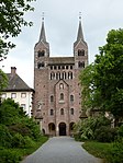 |
Höxter, Germany, 51°46′42″N 9°24′37″E / 51.77833°N 9.41028°E |
Cultural: (ii), (iii), (iv) |
12 (30) | 2014 | The abbey church was built between AD 822 and 885. Today the westwork is the only standing structure that dates back to the Carolingian era, while the ruins of the abbey are only partly excavated. It was an important center of early Frankish imperial administration and in the spread of Christianity in Germany.[36] |
| Castles and Town Walls of King Edward in Gwynedd |  |
Gwynedd, Wales, 53°8′23″N 4°16′37″W / 53.13972°N 4.27694°W |
Cultural: (i), (iii), (iv) |
6 (15) | 1986 | During the reign of Edward I of England (1272–1307), a series of castles were constructed in Wales with the purpose of subduing the population and establishing English colonies in Wales. The World Heritage Site covers many castles including Beaumaris, Caernarfon, Conwy, and Harlech. The castles of Edward I are considered the pinnacle of military architecture by military historians.[37][38] |
| Castles of Augustusburg and Falkenlust at Brühl |  |
Brühl, North Rhine-Westphalia, 50°49′30″N 6°54′35″E / 50.82500°N 6.90972°E |
Cultural: (ii), (iv) |
89 (220) | 1984 | Augustusburg Castle, the residence of the prince-archbishops of Cologne, and the Falkenlust hunting lodge are both examples of early German Rococo architecture.[39] |
| Cathedral of Notre-Dame, Former Abbey of Saint-Rémi and Palace of Tau, Reims | 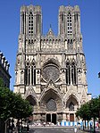 |
Reims, 49°15′12″N 4°1′58″E / 49.25333°N 4.03278°E |
Cultural: (i), (ii), (vi) |
4.16 (10.3) | 1991 | Notre-Dame in Reims is one of the masterpieces of Gothic art. The former abbey still has its beautiful 9th-century nave, in which lie the remains of Archbishop St Rémi (440–533), who instituted the Holy Anointing of the kings of France. The former archiepiscopal palace known as the Tau Palace, which played an important role in religious ceremonies, was almost entirely rebuilt in the 17th century.[40] |
| The Causses and the Cévennes |  |
Southern France, 44°13′13″N 3°28′23″E / 44.22028°N 3.47306°E |
Cultural: (iii), (v) |
302,319 (747,050) | 2011 | This site, in the southern part of central France, displays the relationship between local farming and the environment. The region is mountainous with numerous narrow valleys. The local farmers had to adapt to raise food in this difficult landscape. The valleys of the Causses were developed and controlled by large abbeys, starting in the 11th century. Mont Lozère is one of the last places where summer transhumance is still practiced in the traditional way.[41] |
| Caves and Ice Age Art in the Swabian Jura |  |
Ach and Lone Valleys, 48°23′16″N 9°45′56″E / 48.38778°N 9.76556°E 48°32′56″N 10°10′32″E / 48.54889°N 10.17556°E |
Cultural: (iii) |
462.1 (1,142) | 2017 | Excavated from the 1860s, six caves have revealed items dating from 43,000 to 33,000 years ago, including one statuette of a female form, carved figurines of animals, musical instruments and items of personal adornment. These archaeological sites feature some of the oldest figurative art worldwide and help shed light on the origins of human artistic development.[42] |
| Champagne hillsides, houses and cellars | 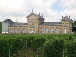 |
Marne, 49°04′39″N 3°56′46″E / 49.07750°N 3.94611°E |
Cultural: (iii), (iv), (vi) |
1,101 (2,720) | 2015 | This site includes historic vineyards of Hautvillers, Aÿ and Mareuil-sur-Aÿ, Saint-Nicaise Hill in Reims and Avenue de Champagne and Fort Chabrol in Épernay.[43] |
| Chartres Cathedral | 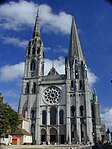 |
Chartres, 48°26′51″N 1°29′14″E / 48.44750°N 1.48722°E |
Cultural: (i), (ii), (iv) |
1.06 (2.6) | 1979 | The cathedral was started in 1145 and rebuilt after a fire in 1194. It is a masterpiece of French Gothic art. The sculptures are from the 12th century and the stained-glass windows are from the 12th and 13th centuries.[44] |
| Chaîne des Puys - Limagne fault tectonic arena |  |
Auvergne-Rhône-Alpes, 45°30′N 2°48′E / 45.5°N 2.8°E |
Natural: (viii) |
24,223 (59,860) | 2018 | [45] |
| La Chaux-de-Fonds / Le Locle, Watchmaking Town Planning |  |
Canton of Neuchâtel, 47°6′14″N 6°49′58″E / 47.10389°N 6.83278°E |
Cultural: (iv) |
284 (700) | 2009 | The site consists of two towns situated close to one another in a remote environment in the Swiss Jura mountains. Due to poor agricultural land, the watchmaking industry developed in the towns in the 19th century. After several devastating fires the towns were rebuilt to support this single industry. The town of La Chaux-de-Fonds was described by Karl Marx as a “huge factory-town” in Das Kapital where he analyzed the division of labour in the watchmaking industry of the Jura.[46] |
| Cistercian Abbey of Fontenay |  |
Marmagne, Côte-d'Or, 47°38′22″N 4°23′21″E / 47.63944°N 4.38917°E |
Cultural: (iv) |
5.77 (14.3) | 1981 | The monastery was founded by St Bernard in 1119. The abbey was built to be self-sufficient and to isolate the residents from the outside world. In addition to the church and monks' quarters, it had a bakery and ironworks to help make it independent.[47] |
| City of Bath | 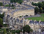 |
Somerset, England, 51°22′53″N 2°21′31″W / 51.38139°N 2.35861°W |
Cultural: (i), (ii), (iv) |
2,900 (7,200) | 1987 | Founded by the Romans as a spa, an important centre of the wool industry in the medieval period, and a spa town in the 18th century, Bath has a varied history. The city is preserved for its Roman remains and Palladian architecture.[48] |
| City of Graz – Historic Centre and Schloss Eggenberg |  |
Styria, 47°4′27″N 15°23′30″E / 47.07417°N 15.39167°E |
Cultural: (ii), (iv) |
— | 1999 | A branch of the Habsburg family lived in Graz for centuries. The Habsburgs and other local nobles beautified and expanded Graz over centuries, leading to a city with grand buildings in a number of styles.[49] |
| City of Luxembourg: its Old Quarters and Fortifications |  |
49°36′36″N 6°7′59.988″E / 49.61000°N 6.13333000°E |
Cultural: (iv) |
30 (74) | 1994 | Luxembourg occupies a strategically important location in the region. Over the centuries it was traded back and forth by the great powers in Europe, each of which fortified and expanded the city. Though many of the walls were dismantled in 1867, portions still remain.[50] |
| Classical Weimar |  |
Thuringia, 50°58′39″N 11°19′43″E / 50.97750°N 11.32861°E |
Cultural: (iii), (vi) |
— | 1998 | Weimar became a cultural center in the late 18th and early 19th centuries. Among the many artists and writers, the city was home to Goethe and Schiller. During this same period elegant buildings and parks were built in Weimar.[51] |
| The Climats, terroirs of Burgundy |  |
Côte-d'Or, 47°03′29″N 4°51′52″E / 47.05806°N 4.86444°E |
Cultural: (iii), (v) |
13,219 (32,660) | 2015 | [52] |
| Collegiate Church, Castle, and Old Town of Quedlinburg |  |
Harz, 51°47′0″N 11°9′0″E / 51.78333°N 11.15000°E |
Cultural: (iv) |
90 (220) | 1994 | The preservation of old Quedlinberg allows tourists to see 16th- and 17th-century timber-framed houses and walk down medieval-patterned streets, while the Romanesque castle and cathedral, housing the bodies of Henry I and his wife, tower over the town.[53] |
| Cologne Cathedral |  |
Cologne, 50°56′28″N 6°57′26″E / 50.94111°N 6.95722°E |
Cultural: (i), (ii), (iv) |
— | 1996 | While work on the Cologne Cathedral began in 1248, it remained incomplete until the Prussians picked up the task centuries later, finishing the job in 1880. It was heavily bombed in the Second World War, but restorations allowed it to become the most visited landmark in Germany, boasting 6.5 million visitors per year as of 2011.[54][55] |
| Convent of St Gall |  |
St. Gallen, 47°25′24″N 9°22′40″E / 47.42333°N 9.37778°E |
Cultural: (ii), (iv) |
— | 1983 | The Carolingian Convent of St Gall was one of the most important in Europe. It was in operation from the 8th century to its secularization in 1805. Its library is one of the richest and oldest in the world and contains a number of precious manuscripts such as the Plan of Saint Gall. Portions of the building were rebuilt in the Baroque style.[56] |
| Cornwall and West Devon Mining Landscape | 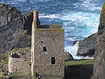 |
South West England, 50°8′10″N 5°23′1″W / 50.13611°N 5.38361°W |
Cultural: (ii), (iii), (iv) |
19,719 (48,730) | 2006 | Tin and copper mining in Devon and Cornwall boomed in the 18th and 19th centuries, and at its peak the area produced two-thirds of the world's copper. The techniques and technology involved in deep mining developed in Devon and Cornwall were used around the world.[57] |
| Decorated Cave of Pont d’Arc, known as Grotte Chauvet-Pont d’Arc, Ardèche |  |
Vallon-Pont-d'Arc, 44°23′20″N 4°24′59″E / 44.38889°N 4.41639°E |
Cultural: (i), (iii) |
9 (22) | 2014 | The cave is home to over 1000 paintings and drawing from about 30,000 to 32,000 years before present as well as flora and fauna remains. It contains the earliest and best preserved examples of prehistoric cave art. The art is especially notable for its use of color, motion, anatomical precision and three-dimensionality.[58] |
| Defence Line of Amsterdam | 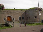 |
Amsterdam, 52°22′28″N 4°53′35″E / 52.37444°N 4.89306°E |
Cultural: (ii), (iv), (v) |
14,953 (36,950) | 1996 | Known in Dutch as the Stelling van Amsterdam, the 135-kilometre (84 mi) defence line surrounding the city was completed in 1920 to protect it from naval threats coming through the Markermeer. It was designed to temporarily flood the area comprising the line, enabling the 45 armed forts along it to effectively stage their countermeasures.[59] |
| Derwent Valley Mills |  |
Derbyshire, England, 53°1′44″N 1°29′17″W / 53.02889°N 1.48806°W |
Cultural: (ii), (iv) |
1,229 (3,040) | 2001 | The Derwent Valley Mills was the birthplace of the factory system; the innovations in the valley, including the development of workers' housing – such as at Cromford – and machines such as the water frame, were important in the Industrial Revolution. The Derwent Valley Mills influenced North America and Europe.[60][61] |
| Dorset and East Devon Coast | 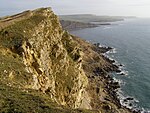 |
Dorset, England, 50°42′20″N 2°59′23.6″W / 50.70556°N 2.989889°W |
Natural: (viii) |
2,550 (6,300) | 2001 | The cliffs that make up the Dorset and Devon coast are an important site for fossils and provide a continuous record of life on land and in the sea in the area since 185 million years ago.[62] |
| Droogmakerij de Beemster (Beemster Polder) |  |
North Holland, 52°32′56″N 4°54′40″E / 52.54889°N 4.91111°E |
Cultural: (i), (ii), (iv) |
— | 1999 | The early 17th-century Beemster Polder is a series of fields, roads, canals, dykes and settlements all built on land reclaimed from the sea.[63] |
| Durham Castle and Cathedral | 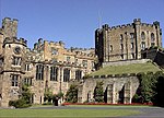 |
Durham, England, 54°46′29″N 1°34′34″W / 54.77472°N 1.57611°W |
Cultural: (ii), (iv), (vi) |
8.79 (21.7) | 1986 | Durham Cathedral is the "largest and finest" example of Norman architecture in England and vaulting of the cathedral was part of the advent of Gothic architecture. The cathedral houses relics of St Cuthbert and Bede. The Norman castle was the residence of the Durham prince-bishops.[64] |
| The English Lake District | 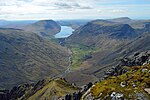 |
North West England, 54°28′36″N 3°4′57″W / 54.47667°N 3.08250°W |
Cultural: (ii), (v), (vi) |
229,205.19 (566,378.4) | 2017 | The combined work of nature and human activity has produced a harmonious landscape in which the mountains are mirrored in the lakes. Grand houses, gardens and parks have been purposely created to enhance the beauty of this landscape. This landscape was greatly appreciated from the 18th century onwards by the Picturesque and later Romantic movements, which celebrated it in paintings, drawings and words. It also inspired an awareness of the importance of beautiful landscapes and triggered early efforts to preserve them.[65] |
| Episcopal City of Albi |  |
Tarn, 43°55′42″N 2°8′33″E / 43.92833°N 2.14250°E |
Cultural: (iv), (v) |
19 (47) | 2010 | The once powerful Albi, founded as an agricultural town, gradually shifted its theme from fortifications to a much more classical Renaissance look that survives as a testament to the two eras in human history.[66] |
| Erzgebirge/Krušnohoří Mining Region |  |
Saxony, 50°24′23″N 12°50′14″E / 50.40639°N 12.83722°E |
Cultural: (ii), (iii), (iv) |
6,766.057 (16,719.29) | 2019 | The mountains in south-west Germany and north-west Czechia have been a source of metals including silver, tin and uranium beginning in the 12th century. The cultural landscape of the region was shaped by mining and smelting innovations.[67] |
| Fagus Factory in Alfeld |  |
Alfeld, 51°59′1″N 9°48′40″E / 51.98361°N 9.81111°E |
Cultural: (ii), (iv) |
1.88 (4.6) | 2011 | Built by Walter Gropius in 1910, the factory designed to manufacture shoe last was renowned for redefining decorative values of the time period, particularly in the wide use of glass to render the building much more homogeneous, which foreshadowed his later work with the Bauhaus.[68] |
| Fertö / Neusiedlersee Cultural Landscape |  |
Burgenland and Győr-Moson-Sopron County, 47°43′9.4″N 16°43′21.8″E / 47.719278°N 16.722722°E |
Cultural: (v) |
52 (130) | 2001 | The Fertö/Neusiedler Lake area has been occupied by different peoples for eight millennia. A number of 18th- and 19th-century villages and castles were built on top of the ancient settlements and landscape.[69] |
| Flemish Béguinages | 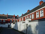 |
Flanders, 51°1′52″N 4°28′26″E / 51.03111°N 4.47389°E |
Cultural: (ii), (iii), (iv) |
60 (150) | 1998 | The communities, called "béguinages", were built by the Béguines, religious women who "dedicated their lives to God without retiring from the world". Entire Flemish towns were created in the 13th century based on this principle of life.[70] |
| Forth Bridge |  |
Scotland, 56°0′3″N 3°23′23″W / 56.00083°N 3.38972°W |
Cultural: (i), (iv) |
7.5 (19) | 2015 | The Forth Bridge is a cantilever railway bridge over the Firth of Forth, 9 miles (14 kilometres) west of Edinburgh City Centre. It is considered an iconic structure and a symbol of Scotland, and was designed by the English engineers Sir John Fowler and Sir Benjamin Baker.[71] |
| Fortifications of Vauban |  |
50°16′57″N 2°45′32″E / 50.28250°N 2.75889°E |
Cultural: (i), (ii), (iv) |
1,153 (2,850) | 2008 | The UNESCO entry covers 12 groups of fortified buildings in France engineered by Sébastien Le Prestre, who worked under Louis XIV in the 17th century.[72] |
| The Four Lifts on the Canal du Centre and their Environs, La Louvière and Le Roeulx |  |
La Louvière, 50°28′52″N 4°8′14″E / 50.48111°N 4.13722°E |
Cultural: (iii), (iv) |
67 (170) | 1998 | The hydraulic lifts along the Canal du Centre were made to overcome the 89.46-metre (293.5 ft) height difference between Mons and Charleroi. They are the last functioning lifts built at the turn of the 20th century.[73] |
| Frontiers of the Roman Empire |  |
Central Lowlands, Northern England, and Southern Germany 54°59′33″N 2°36′4″W / 54.99250°N 2.60111°W |
Cultural: (ii), (iii), (iv) |
527 (1,300) | 1987 | Hadrian's Wall was built in 122 AD and the Antonine Wall was constructed in 142 AD to defend the Roman Empire from "barbarians".[74] The World Heritage Site was previously listed as Hadrian's Wall alone, but was later expanded to include all the frontiers of the Roman Empire at its zenith in the 2nd century, ranging from Antonine's Wall in the north to Trajan's Wall in eastern Europe.[74] |
| Garden Kingdom of Dessau-Wörlitz |  |
Saxony-Anhalt, 51°50′33″N 12°25′15″E / 51.84250°N 12.42083°E |
Cultural: (ii), (iv) |
14,500 (36,000) | 2000 | "The Garden Kingdom of Dessau-Wörlitz is an outstanding example of the application of the philosophical principles of the Age of the Enlightenment to the design of a landscape that integrates art, education and economy in a harmonious whole."[75] |
| Giant's Causeway and Causeway Coast |  |
County Antrim, Northern Ireland, 55°15′0″N 6°29′7″W / 55.25000°N 6.48528°W |
Natural: (vii), (viii) |
70 (170) | 1986 | The causeway is made up of 40,000 basalt columns projecting out of the sea. It was created by volcanic activity in the Tertiary period.[76] |
| La Grand-Place, Brussels |  |
Brussels, 50°50′48.048″N 4°21′9″E / 50.84668000°N 4.35250°E |
Cultural: (ii), (iv) |
1.48 (3.7) | 1998 | Featuring Brussels' city hall, houses and other historic buildings, La Grand-Place is a well-preserved testament to the social and cultural life of the late 17th century.[77] |
| Gulf of Porto: Calanche of Piana, Gulf of Girolata, Scandola Reserve |  |
Corsica, 42°19′31″N 8°37′43.8″E / 42.32528°N 8.628833°E |
Natural: (vii), (viii), (x) |
11,800 (29,000) | 1983 | The Gulf of Porto is part of the Corsica Regional Park, hosting a variety of marine and avian life, as well as shrubland.[78] |
| Hallstatt-Dachstein / Salzkammergut Cultural Landscape |  |
Salzkammergut, 47°33′34″N 13°38′47″E / 47.55944°N 13.64639°E |
Cultural: (iii), (iv) |
28,446 (70,290) | 1997 | The region built itself around salt mining, which began as early as 2,000 BCE and continued in the modern era. The region is also known for its mountain ranges and caves, the longest of the latter reaching a length of 81 km (50 mi).[79] |
| Hanseatic City of Lübeck |  |
Schleswig-Holstein, 53°52′0″N 10°41′30″E / 53.86667°N 10.69167°E |
Cultural: (iv) |
81 (200) | 1987 | Lübeck was the trading capital of the influential Hanseatic League, which monopolised trade in much of Northern Europe. Although a fifth of the city was entirely destroyed in World War II, much of the original 12th-century architecture remains.[80] |
| Heart of Neolithic Orkney |  |
Mainland, Scotland, 58°59′45.8″N 3°11′19″W / 58.996056°N 3.18861°W |
Cultural: (i), (ii), (iii), (iv) |
15 (37) | 1999 | A collection of Neolithic sites with purposes ranging from occupation to ceremony. It includes the settlement of Skara Brae, the chambered tomb of Maes Howe and the stone circles of Stenness and Brodgar.[81] |
| Historic Centre of Avignon: Papal Palace, Episcopal Ensemble and Avignon Bridge |  |
Vaucluse, 43°57′10″N 4°48′22″E / 43.95278°N 4.80611°E |
Cultural: (i), (ii), (iv) |
8.2 (20) | 1995 | [82] |
| Historic Centre of Brugge |  |
West Flanders, 51°12′32.076″N 3°13′30.972″E / 51.20891000°N 3.22527000°E |
Cultural: (ii), (iv), (vi) |
410 (1,000) | 2000 | One of the economic and commercial capitals of Europe in the late-Medieval period, Bruges boasts its intact Gothic and neo-Gothic architecture, which respectively documents its style from the Middle Ages to the Renaissance.[83] |
| Historic Centre of Salzburg |  |
Salzburg, 47°48′2″N 13°2′36″E / 47.80056°N 13.04333°E |
Cultural: (ii), (iv), (vi) |
236 (580) | 1996 | Best associated with Austrian composer Wolfgang Amadeus Mozart, Salzburg is known for its ecclesiastic city-state qualities only second to Vatican City. It is also where German and Italian cultures intersected, which is reflected by its blend of Gothic- and Baroque-style buildings.[84] |
| Historic Centre of Vienna |  |
48°13′0″N 16°22′59″E / 48.21667°N 16.38306°E |
Cultural: (ii), (iv), (vi) |
371 (920) | 2001 | "The historic centre of Vienna is rich in architectural ensembles, including Baroque castles and gardens, as well as the late-19th-century Ringstraße lined with grand buildings, monuments and parks."[85] |
| Historic Centres of Stralsund and Wismar | 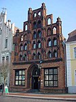 |
Mecklenburg-Vorpommern, 54°18′9″N 13°5′7″E / 54.30250°N 13.08528°E |
Cultural: (ii), (iv) |
168 (420) | 2002 | The two towns were major Hanseatic League trading centres in the 14th and 15th centuries. They then served as defensive and administrative centres for Sweden two hundred years later, notably during the Thirty Years' War. The architectural styles from both of these periods remain and are well-preserved.[86] |
| Historic Fortified City of Carcassonne |  |
Aude, 43°12′38″N 2°21′32″E / 43.21056°N 2.35889°E |
Cultural: (ii), (iv) |
11 (27) | 1997 | [87] |
| Historic Site of Lyon |  |
Rhône, 45°46′2″N 4°50′0″E / 45.76722°N 4.83333°E |
Cultural: (ii), (iv) |
427 (1,060) | 1998 | [88] |
| Ir.D.F. Woudagemaal (D.F. Wouda Steam Pumping Station) |  |
Lemmer, 52°50′45″N 5°40′44″E / 52.84583°N 5.67889°E |
Cultural: (i), (ii), (iv) |
7.32 (18.1) | 1998 | [89] |
| Ironbridge Gorge | 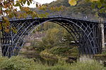 |
Shropshire, England, 52°37′35″N 2°28′22″W / 52.62639°N 2.47278°W |
Cultural: (i), (ii), (iv), (vi) |
— | 1986 | Ironbridge Gorge contains mines, factories, workers' housing, and the transport infrastructure that was created in the gorge during the Industrial Revolution. The development of coke production in the area helped start the Industrial Revolution. The Iron Bridge was the world's first bridge built from iron and was architecturally and technologically influential.[90] |
| Jodrell Bank Observatory |  |
Cheshire, England, 53°14.5′N 2°18.7′W / 53.2417°N 2.3117°W |
Cultural: (i), (ii), (iv), (vi) |
17.38 (42.9) | 2019 | [91] |
| Jurisdiction of Saint-Émilion |  |
Gironde, 44°53′41″N 0°9′19″E / 44.89472°N 0.15528°E |
Cultural: (iii), (iv) |
7,847 (19,390) | 1999 | The act of cultivating grapes was introduced to the region by the Romans around 27 BCE and became a large and enduring part of its economy over the course of the following millennia, despite wars and the changes of rule. Occupying 67.5% of the total commune, the vineyards accompany historic monuments and buildings in documenting a monocultural community's history.[92] |
| Mill Network at Kinderdijk-Elshout |  |
Alblasserdam and Nieuw-Lekkerland, 51°52′57″N 4°38′58″E / 51.88250°N 4.64944°E |
Cultural: (i), (ii), (iv) |
Zdroj:https://en.wikipedia.org?pojem=List_of_World_Heritage_Sites_in_Western_Europe

