A | B | C | D | E | F | G | H | CH | I | J | K | L | M | N | O | P | Q | R | S | T | U | V | W | X | Y | Z | 0 | 1 | 2 | 3 | 4 | 5 | 6 | 7 | 8 | 9
Nairobi | |
|---|---|
 Clockwise from top: central business district; a giraffe walking in Nairobi National Park; Parliament of Kenya; Nairobi City Hall; and the Kenyatta International Convention Centre | |
| Nickname: "The Green City in the Sun" | |
| Coordinates: 01°17′11″S 36°49′02″E / 1.28639°S 36.81722°E | |
| Country | Kenya |
| County | Nairobi City |
| Founded | 1899 |
| Sub-counties | |
| Government | |
| • Body | Nairobi City County |
| • Legislature | County Assembly |
| • Governor | Johnson Sakaja |
| Area | |
| • Consolidated city-county | 696.1 km2 (268.8 sq mi) |
| Elevation | 1,795 m (5,500 ft) |
| Population (2019)[3] | |
| • Consolidated city-county | 4,397,073 |
| • Estimate (2024)[4] | 4,828,000 |
| • Density | 6,317.6/km2 (16,363/sq mi) |
| • Urban | 4,397,073 |
| Demonym | Nairobian |
| Time zone | UTC+3 (EAT) |
| Area code | 020 |
| HDI (2019) | 0.681[5] - medium |
| GDP (2023) | 30 billion USD[6] |
| GDP PPP (2023) | 90 billion USD[6] |
| Website | nairobi |
Nairobi (/naɪˈroʊbi/ ny-ROH-bee) is the capital and largest city of Kenya. The name is derived from the Maasai phrase Enkare Nairobi, which translates to 'place of cool waters', a reference to the Nairobi River which flows through the city. The city proper had a population of 4,397,073 in the 2019 census.[7][8] The city is commonly referred to as The Green City in the Sun.[9]
Nairobi was founded in 1899 by colonial authorities in British East Africa, as a rail depot on the Uganda - Kenya Railway. It was favoured by the authorities as an ideal resting place due to its high elevation, temperate climate, and adequate water supply.[10] The town quickly grew to replace Mombasa as the capital of Kenya in 1907.[11]
After independence in 1963, Nairobi became the capital of the Republic of Kenya.[12] During Kenya's early period, the city became a centre for the coffee, tea and sisal industries.[13][14] The city lies in the south central part of Kenya, at an elevation of 1,795 metres (5,889 ft).
Nairobi is home of the Kenyan Parliament Buildings and hosts thousands of Kenyan businesses and key international companies and organizations, including the United Nations Environment Programme (UN Environment) and the United Nations Office at Nairobi (UNON). Nairobi is an established hub for business and culture. The Nairobi Securities Exchange (NSE) is one of the largest stock exchanges in Africa and the second-oldest exchange on the continent. It is Africa's fourth-largest stock exchange exchange in terms of trading volume, capable of making 10 million trades a day. It also contains the Nairobi National Park. Nairobi joined the UNESCO Global Network of Learning Cities in 2010.
History
Early years

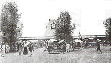
The site of Nairobi was originally a swamp land occupied by a pastoralist people, the Maasai, the sedentary Akamba People, as well as the agriculturalist Kikuyu people.[15] The name Nairobi itself comes from the Maasai expression meaning "cool waters", referring to the cold water stream which flowed through the area.[16] With the arrival of the Uganda Railway, the site was identified by Sir George Whitehouse for a store depot, shunting ground and camping ground for the Indian labourers working on the railway. Whitehouse, chief engineer of the railway, favoured the site as an ideal resting place due to its high elevation, temperate climate, adequate water supply and being situated before the steep ascent of the Limuru escarpments.[17][18] His choice was however criticised by officials within the Protectorate government who felt the site was too flat, poorly drained and relatively infertile.[15]

During the pre-colonial era, the people of modern Kenya mostly lived in villages amongst their tribes and cultural groups, where they had rulers within their communities rather than one singular government or leader.[19]
In 1898, Arthur Church was first and foremost commissioned to design the first town layout for the railway depot. It constituted two streets – Victoria Street and Station Street, ten avenues, staff quarters and an Indian commercial area.[17] The railway arrived at Nairobi on 30 May 1899, and soon Nairobi replaced Machakos as the headquarters of the provincial administration for Ukamba province.[20][21] On the arrival of the railway, Whitehouse remarked that "Nairobi itself will in the course of the next two years become a large and flourishing place and already there are many applications for sites for hotels, shops and houses."[17] The town's early years were however beset with problems of malaria leading to at least one attempt to have the town moved.[22] In the early 1900s, Bazaar Street (now Biashara Street) was completely rebuilt after an outbreak of plague and the burning of the original town.[23]
Between 1902 and 1910, the town's population rose from 5,000 to 16,000 and grew around administration and tourism, initially in the form of big game hunting.[24] In 1907, Nairobi replaced Mombasa as the capital of the East Africa Protectorate.[25] In 1919, Nairobi was declared to be a municipality.[26][27]
Growth
In 1921, Nairobi had 24,000 residents, of which 12,000 were native Africans.[28] The next decade saw growth in native African communities in Nairobi, and they began to constitute a majority for the first time.[28] This growth caused planning issues, described by Thorntorn White Archived 22 October 2020 at the Wayback Machine and his planning team as the "Nairobi Problem".[29] In February 1926, colonial officer Eric Dutton passed through Nairobi on his way to Mount Kenya, and said of the city:
Maybe one day Nairobi will be laid out with tarred roads, with avenues of flowering trees, flanked by noble buildings; with open spaces and stately squares; a cathedral worthy of faith and country; museums and of art; theatres and public offices. And it is fair to say that the Government and the Municipality have already bravely tackled the problem and that a town-plan ambitious enough to turn Nairobi into a thing of beauty has been slowly worked out, and much has already been done. But until that plan has borne fruit, Nairobi must remain what she was then, a slatternly creature, unfit to queen it over so lovely a country.[30]
After World War II, continuous expansion of the city angered both the indigenous Maasai and Kikuyu.[31] This led to the Mau Mau Uprising in the 1950s, and the Lancaster House Conferences, which initiated a transition to Kenyan independence in 1963.
In the spring of 1950, the East African Trades Union Congress (EAUTC) led a nine-day general strike in the city.[32][33]
Post independence

Nairobi remained the capital of Kenya after independence, and its continued rapid growth put pressure on the city's infrastructure with power cuts and water shortages becoming a common occurrence.
On 11 September 1973, the Kenyatta International Conference Centre KICC was open to the public. The 28-storey building at the time was designed by the Norwegian architect Karl Henrik Nøstvik and Kenyan David Mutiso. It is the only building within the city with a helipad that is open to the public. Of the buildings built in the Seventies, the KICC was the most eco-friendly and most environmentally conscious structure; its main frame was constructed with locally available materials gravel, sand, cement and wood, and it had wide open spaces which allowed for natural aeration and natural lighting. Cuboids made up the plenary hall, the tower consisted of a cylinder composed of several cuboids, and the amphitheater and helipad both resembled cones. The tower was built around a concrete core and it had no walls but glass windows, which allowed for maximum natural lighting. It had the largest halls in eastern and central Africa.[34]
A years prior in 1972, the World Bank approved funds for further expansion of the then Nairobi Airport (now Jomo Kenyatta International Airport), including a new international and domestic passenger terminal building, the airport's first dedicated cargo and freight terminal, new taxiways, associated aprons, internal roads, car parks, police and fire stations, a State Pavilion, airfield and roadway lighting, fire hydrant system, water, electrical, telecommunications and sewage systems, a dual carriageway passenger access road, security, drainage and the building of the main access road to the airport (Airport South Road). The total cost of the project was more than US$29 million (US$111.8 million in 2013 dollars).[35] On 14 March 1978, construction of the terminal building was completed on the other side of the airport's single runway and opened by President Jomo Kenyatta less than five months before his death. The airport was renamed Jomo Kenyatta International Airport in memory of its first president.
The Giraffe Centre, an animal sanctuary on the southwestern outskirts of Nairobi, was opened in 1983. To this day, it breeds the endangered species of Rothschild's giraffe.
The United States Embassy, then located in downtown Nairobi, was bombed in August 1998 by Al-Qaeda and the Egyptian Islamic Jihad, as one of a series of US embassy bombings. It is now the site of a memorial park.[36]
21st century


On 20 October 2011, a memorial statue was unveiled in Nairobi in memory to Tom Mboya, a former Kenyan Independence politician and assassination victim.
On 9 November 2012, President Mwai Kibaki opened the KES 31 billion Thika Superhighway. This mega-project of Kenya started in 2009 and ended in 2011. It involved expanding the four-lane carriageway to eight lanes, building underpasses, providing interchanges at roundabouts, erecting flyovers and building underpasses to ease congestion. The 50.4-kilometre road was built in three phases: Uhuru Highway to Muthaiga Roundabout; Muthaiga Roundabout to Kenyatta University and; Kenyatta University to Thika Town.[37]
On 31 May 2017, President Uhuru Kenyatta inaugurated the Standard Gauge Railway which connects Nairobi to Mombasa.[38] It was primarily built by a Chinese firm with about 90% of total funding from China and about 10% from the Kenyan government. A second phase is also being built which will link Naivasha to the existing route and also the Uganda border.
On 11 August 2020, Nairobi County Assembly Speaker Beatrice Elachi resigned.[39] On 21 December 2020, recently elected[40] Nairobi County Assembly Speaker Benson Mutura was sworn in as acting Nairobi Governor four days after the previous Nairobi Governor Mike Sonko was impeached and removed from office.[41] At the time of Mutura's swearing in as acting Governor, which he will hold for at least 60 days, Nairobi did not have a Deputy Governor as well.[41]
Historical population data for Nairobi
| Year | 1969 | 1979 | 1989 | 1999 | 2009 | 2019 |
|---|---|---|---|---|---|---|
| Nairobi | 509,286 | 827,775 | 1,324,570 | 2,143,254 | 3,138,369 | 4,397,073[42] |
Geography

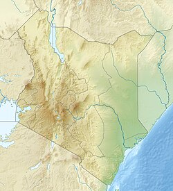
The city is situated at 1°09′S 36°39′E / 1.150°S 36.650°E and 1°27′S 37°06′E / 1.450°S 37.100°E and occupies 696 square kilometres (270 sq mi).
Nairobi is situated between the cities of Kampala and Mombasa. As Nairobi is adjacent to the eastern edge of the Rift Valley, minor earthquakes and tremors occasionally occur. The Ngong Hills, located to the west of the city, are the most prominent geographical feature of the Nairobi area. Mount Kenya is situated north of Nairobi, and Mount Kilimanjaro is towards the south-east.[43]
The Nairobi River and its tributaries traverse through the Nairobi County and joins the larger River Athi on the eastern edge of the county.

Nobel Peace Prize laureate Wangari Maathai fought fiercely to save the indigenous Karura Forest in northern Nairobi which was under threat of being replaced by housing and other infrastructure.[44]
Nairobi's western suburbs stretch all the way from the Kenyatta National Hospital in the south to the UN headquarters at Gigiri suburb in the north, a distance of about 20 kilometres (12 mi). The city is centred on the City Square, which is located in the Central Business District. The Kenyan Parliament buildings, the Holy Family Cathedral, Nairobi City Hall, Nairobi Law Courts, and the Kenyatta Conference Centre all surround the square.

Climate
Under the Köppen climate classification, Nairobi has a subtropical highland climate (Cwb). At 1,795 metres (5,889 ft) above sea level, evenings may be cool, especially in the June/July season, when the temperature can drop to 9 °C (48 °F). The sunniest and warmest part of the year is from December to March, when temperatures average in the high-twenties Celsius during the day. The mean maximum temperature for this period is 28 °C (82 °F).[45]
There are rainy seasons, but rainfall can be moderate. The cloudiest part of the year is just after the first rainy season, when, until September, conditions are usually overcast with drizzle. As Nairobi is situated close to the equator, the differences between the seasons are minimal. The seasons are referred to as the wet season and dry season. The timing of sunrise and sunset varies little throughout the year for the same reason.[46]
| Climate data for Nairobi (Dagoretti) 1961–1990, extremes 1955–1982 and 1984–present | |||||||||||||
|---|---|---|---|---|---|---|---|---|---|---|---|---|---|
| Month | Jan | Feb | Mar | Apr | May | Jun | Jul | Aug | Sep | Oct | Nov | Dec | Year |
| Record high °C (°F) | 34.8 (94.6) |
33.5 (92.3) |
32.9 (91.2) |
29.0 (84.2) |
26.8 (80.2) |
28.1 (82.6) |
32.7 (90.9) |
32.5 (90.5) |
30.0 (86.0) |
32.0 (89.6) |
37.9 (100.2) |
35.6 (96.1) |
37.9 (100.2) |
| Mean daily maximum °C (°F) | 25.5 (77.9) |
26.7 (80.1) |
27.7 (81.9) |
25.8 (78.4) |
23.5 (74.3) |
22.5 (72.5) |
22.0 (71.6) |
22.7 (72.9) |
25.0 (77.0) |
25.7 (78.3) |
24.0 (75.2) |
24.5 (76.1) |
24.6 (76.4) |
| Daily mean °C (°F) | 19.7 (67.5) |
20.2 (68.4) |
21.0 (69.8) |
19.5 (67.1) |
17.8 (64.0) |
16.3 (61.3) |
15.6 (60.1) |
15.9 (60.6) |
17.3 (63.1) |
18.5 (65.3) |
18.4 (65.1) |
18.1 (64.6) |
18.2 (64.7) |
| Mean daily minimum °C (°F) | 12.7 (54.9) |
12.7 (54.9) |
13.8 (56.8) |
14.0 (57.2) |
12.1 (53.8) |
10.0 (50.0) |
9.2 (48.6) |
9.1 (48.4) |
9.7 (49.5) |
11.3 (52.3) |
12.7 (54.9) |
11.7 (53.1) |
11.6 (52.9) |
| Record low °C (°F) | 3.3 (37.9) |
2.2 (36.0) |
6.7 (44.1) |
7.8 (46.0) |
Zdroj:https://en.wikipedia.org?pojem=Nairobi,_Kenya|||||||||


