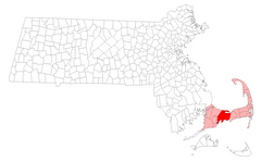
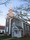
[2] Name on the Register[3]
Image
Date listed[4]
Location
City or town
Description
1
Adams-Crocker-Fish House Adams-Crocker-Fish House March 13, 1987 (#87000219 ) 449 Willow St. 41°42′07″N 70°23′22″W / 41.701944°N 70.389444°W / 41.701944; -70.389444 (Adams-Crocker-Fish House ) Barnstable
2
Josiah A. Ames House Josiah A. Ames House September 18, 1987 (#87000300 ) 145 Bridge St. 41°37′20″N 70°23′46″W / 41.622222°N 70.396111°W / 41.622222; -70.396111 (Josiah A. Ames House ) Barnstable
3
Ancient Burying Ground Ancient Burying Ground March 13, 1987 (#87000283 ) Phinney's Ln. 41°39′17″N 70°20′38″W / 41.6547°N 70.3439°W / 41.6547; -70.3439 (Ancient Burying Ground ) Barnstable
4
Benjamin Baker Jr. House Benjamin Baker Jr. House November 10, 1987 (#87000352 ) 1579 Hyannis Rd. 41°41′42″N 70°18′12″W / 41.695°N 70.303333°W / 41.695; -70.303333 (Benjamin Baker Jr. House ) Barnstable
5
Capt. Seth Baker Jr. House Capt. Seth Baker Jr. House September 18, 1987 (#87000299 ) 35 Main St. 41°39′22″N 70°16′22″W / 41.656111°N 70.272778°W / 41.656111; -70.272778 (Capt. Seth Baker Jr. House ) Barnstable
6
Nathaniel Baker House Nathaniel Baker House March 13, 1987 (#87000229 ) 1606 Hyannis Rd. 41°41′45″N 70°18′08″W / 41.695833°N 70.302222°W / 41.695833; -70.302222 (Nathaniel Baker House ) Barnstable
7
Barnstable County Courthouse Barnstable County Courthouse June 11, 1981 (#81000104 ) Main St. 41°42′05″N 70°18′17″W / 41.701389°N 70.304722°W / 41.701389; -70.304722 (Barnstable County Courthouse ) Barnstable
8
Capt. Rodney J. Baxter House Capt. Rodney J. Baxter House March 13, 1987 (#87000273 ) South and Pearl Sts. 41°39′00″N 70°17′06″W / 41.65°N 70.285°W / 41.65; -70.285 (Capt. Rodney J. Baxter House ) Barnstable
9
Capt. Sylvester Baxter House Capt. Sylvester Baxter House March 13, 1987 (#87000313 ) 156 Main St. 41°39′19″N 70°16′39″W / 41.655278°N 70.2775°W / 41.655278; -70.2775 (Capt. Sylvester Baxter House ) Barnstable
10
Charles L. Baxter House Charles L. Baxter House March 13, 1987 (#87000315 ) 77 Main St. 41°38′08″N 70°27′02″W / 41.635556°N 70.450556°W / 41.635556; -70.450556 (Charles L. Baxter House ) Barnstable
11
Shubael Baxter House Shubael Baxter House September 18, 1987 (#87000304 ) 9 E. Bay Rd. 41°37′39″N 70°22′49″W / 41.6275°N 70.380278°W / 41.6275; -70.380278 (Shubael Baxter House ) Barnstable
12
Capt. Allen H. Bearse House Capt. Allen H. Bearse House March 13, 1987 (#87000264 ) 48 Camp St. 41°39′25″N 70°16′33″W / 41.656944°N 70.275833°W / 41.656944; -70.275833 (Capt. Allen H. Bearse House ) Barnstable
13
Capt. Oliver Bearse House Capt. Oliver Bearse House March 13, 1987 (#87000276 ) 39 Pearl St. 41°39′03″N 70°17′07″W / 41.650833°N 70.285278°W / 41.650833; -70.285278 (Capt. Oliver Bearse House ) Barnstable Damaged by fire in 2011 and subsequently demolished.
14
Blish-Garret House Blish-Garret House March 13, 1987 (#87000327 ) 350 Plum St. 41°41′41″N 70°21′21″W / 41.694722°N 70.355833°W / 41.694722; -70.355833 (Blish-Garret House ) Barnstable
15
Building at 237–239 Main Street Building at 237–239 Main Street March 13, 1987 (#87000293 ) 237–239 Main St. 41°39′16″N 70°16′49″W / 41.654444°N 70.280278°W / 41.654444; -70.280278 (Building at 237–239 Main Street ) Barnstable
16
Building at 600 Main Street Building at 600 Main Street March 13, 1987 (#87000286 ) 600 Main St. 41°38′56″N 70°17′28″W / 41.648889°N 70.291111°W / 41.648889; -70.291111 (Building at 600 Main Street ) Barnstable
17
Building at 606 Main Street Building at 606 Main Street March 13, 1987 (#87000287 ) 606 Main St. 41°38′56″N 70°17′28″W / 41.648889°N 70.291111°W / 41.648889; -70.291111 (Building at 606 Main Street ) Barnstable
18
Building at 614 Main Street Building at 614 Main Street March 13, 1987 (#87000285 ) 614 Main St. 41°38′56″N 70°17′28″W / 41.648889°N 70.291111°W / 41.648889; -70.291111 (Building at 614 Main Street ) Barnstable
19
Collen C. Campbell House Collen C. Campbell House March 13, 1987 (#87000297 ) 599 Main St. 41°38′55″N 70°17′27″W / 41.648611°N 70.290833°W / 41.648611; -70.290833 (Collen C. Campbell House ) Barnstable
20
Canary-Hartnett House Canary-Hartnett House March 13, 1987 (#87000260 ) 113 Winter St. 41°39′10″N 70°17′14″W / 41.652778°N 70.287222°W / 41.652778; -70.287222 (Canary-Hartnett House ) Barnstable
21
Centerville Historic District Centerville Historic District November 10, 1987 (#87002587 ) Main St. 41°38′56″N 70°20′53″W / 41.648889°N 70.348056°W / 41.648889; -70.348056 (Centerville Historic District ) Barnstable
22
Lemuel B. Chase House Lemuel B. Chase House March 13, 1987 (#87000267 ) 340 Scudder Ave. 41°38′21″N 70°18′14″W / 41.639167°N 70.303889°W / 41.639167; -70.303889 (Lemuel B. Chase House ) Barnstable
23
Col. Charles Codman Estate Col. Charles Codman Estate March 13, 1987 (#87000321 ) Bluff Point Dr. 41°36′41″N 70°25′58″W / 41.6114°N 70.4328°W / 41.6114; -70.4328 (Col. Charles Codman Estate ) Barnstable
24
Cotuit Historic District Cotuit Historic District November 10, 1987 (#87000317 ) Main St., Lowell and Ocean View Aves. bounded by Osterville Harbor, Nantucket Sound , and Popponessett Bay 41°36′57″N 70°26′14″W / 41.615833°N 70.437222°W / 41.615833; -70.437222 (Cotuit Historic District ) Barnstable
25
Craigville Historic District Craigville Historic District November 10, 1987 (#87000275 ) Centerville Harbor, Nantucket Sound , Red Lily Pond, and Lake Elizabeth 41°38′29″N 70°19′58″W / 41.641389°N 70.332778°W / 41.641389; -70.332778 (Craigville Historic District ) Barnstable
26
Benomi and Barnabas Crocker House Benomi and Barnabas Crocker House March 13, 1987 (#87000216 ) 325 Willow St. 41°42′18″N 70°23′10″W / 41.705°N 70.386111°W / 41.705; -70.386111 (Benomi and Barnabas Crocker House ) Barnstable
27
Capt. Alexander Crocker House Capt. Alexander Crocker House March 13, 1987 (#87000274 ) 358 Sea St. 41°38′20″N 70°17′27″W / 41.638889°N 70.290833°W / 41.638889; -70.290833 (Capt. Alexander Crocker House ) Barnstable
28
Ebenezer Crocker Jr. House Ebenezer Crocker Jr. House November 10, 1987 (#87000323 ) 49 Putnam Ave. 41°37′17″N 70°26′03″W / 41.621389°N 70.434167°W / 41.621389; -70.434167 (Ebenezer Crocker Jr. House ) Barnstable
29
Lot Crocker House Lot Crocker House March 13, 1987 (#87000263 ) 284 Gosnold St. 41°38′19″N 70°17′27″W / 41.638611°N 70.290833°W / 41.638611; -70.290833 (Lot Crocker House ) Barnstable
30
Daniel Crosby House Daniel Crosby House September 18, 1987 (#87000306 ) 18 Bay St. 41°37′44″N 70°23′18″W / 41.628889°N 70.388333°W / 41.628889; -70.388333 (Daniel Crosby House ) Barnstable
31
Crowell-Smith House Crowell-Smith House March 13, 1987 (#87000272 ) 33 Pine St. 41°38′57″N 70°17′19″W / 41.649167°N 70.288611°W / 41.649167; -70.288611 (Crowell-Smith House ) Barnstable
32
Fuller House Fuller House March 13, 1987 (#87000325 ) Parker Rd. 41°41′42″N 70°22′01″W / 41.695°N 70.366944°W / 41.695; -70.366944 (Fuller House ) Barnstable
33
Gifford Farm Gifford Farm March 13, 1987 (#87000245 ) 261 Cotuit Rd. 41°39′26″N 70°24′43″W / 41.657222°N 70.411944°W / 41.657222; -70.411944 (Gifford Farm ) Barnstable
34
Dr. Edward Francis Gleason House Dr. Edward Francis Gleason House September 18, 1987 (#87000262 ) 88 Lewis Bay Rd. 41°39′10″N 70°16′30″W / 41.652778°N 70.275°W / 41.652778; -70.275 (Dr. Edward Francis Gleason House ) Barnstable
35
Goodspeed House Goodspeed House March 13, 1987 (#87000235 ) 271 River Rd. 41°39′32″N 70°25′10″W / 41.658889°N 70.419444°W / 41.658889; -70.419444 (Goodspeed House ) Barnstable
36
Capt. Thomas Gray House Capt. Thomas Gray House March 13, 1987 (#87000280 ) 14 Main St. 41°39′25″N 70°16′20″W / 41.656944°N 70.272222°W / 41.656944; -70.272222 (Capt. Thomas Gray House ) Barnstable
37
Capt. William Hallett House Capt. William Hallett House September 18, 1987 (#87000296 ) 570 Main St. 41°38′59″N 70°17′24″W / 41.649722°N 70.29°W / 41.649722; -70.29 (Capt. William Hallett House ) Barnstable
38
Seth Hallett House Seth Hallett House September 18, 1987 (#87000298 ) 110 Main St. 41°39′22″N 70°16′32″W / 41.656111°N 70.275556°W / 41.656111; -70.275556 (Seth Hallett House ) Barnstable
39
Harlow Homestead Harlow Homestead September 18, 1987 (#87000324 ) 391 Main St. 41°37′42″N 70°26′35″W / 41.628333°N 70.443056°W / 41.628333; -70.443056 (Harlow Homestead ) Barnstable
40
Gideon Hawley House Gideon Hawley House March 13, 1987 (#87000312 ) 4766 Falmouth Rd. 41°38′11″N 70°27′16″W / 41.636389°N 70.454444°W / 41.636389; -70.454444 (Gideon Hawley House ) Barnstable
41
Hinckley Homestead Hinckley Homestead September 18, 1987 (#87000248 ) 1740 S. County Rd. 41°38′57″N 70°23′52″W / 41.649167°N 70.397778°W / 41.649167; -70.397778 (Hinckley Homestead ) Barnstable
42
Capt. Joseph Hinckley House Capt. Joseph Hinckley House March 13, 1987 (#87000249 ) 142 Old Stage Rd. 41°39′14″N 70°21′02″W / 41.653889°N 70.350556°W / 41.653889; -70.350556 (Capt. Joseph Hinckley House ) Barnstable
43
Nymphus Hinckley House Nymphus Hinckley House March 13, 1987 (#87000250 ) 38 Bay St. 41°37′44″N 70°23′18″W / 41.628889°N 70.388333°W / 41.628889; -70.388333 (Nymphus Hinckley House ) Barnstable
44
S. Alexander Hinckley House S. Alexander Hinckley House September 18, 1987 (#87000279 ) 151 Pine St. 41°38′48″N 70°17′13″W / 41.646667°N 70.286944°W / 41.646667; -70.286944 (S. Alexander Hinckley House ) Barnstable
45
Hyannis Port Historic District Hyannis Port Historic District November 10, 1987 (#87000259 ) Roughly bounded by Massachusetts Ave.and Edgehill Rd., Hyannis Ave., Hyannis Harbor, and Scudder Ave. 41°37′52″N 70°17′55″W / 41.631111°N 70.298611°W / 41.631111; -70.298611 (Hyannis Port Historic District ) Barnstable
46
Hyannis Road Historic District Hyannis Road Historic District March 13, 1987 (#87000231 ) Bounded by Old King's Highway, Bow Ln., Cape Cod Branch railroad tracks, and Hyannis Rd. 41°41′23″N 70°18′04″W / 41.689722°N 70.301111°W / 41.689722; -70.301111 (Hyannis Road Historic District ) Barnstable
47
Herman Isham House Herman Isham House March 13, 1987 (#87000295 ) 1322 Main St. 41°38′27″N 70°23′34″W / 41.640833°N 70.392778°W / 41.640833; -70.392778 (Herman Isham House ) Barnstable
48
John Jenkins Homestead John Jenkins Homestead March 13, 1987 (#87000318 ) Church St. 41°41′41″N 70°22′12″W / 41.694722°N 70.37°W / 41.694722; -70.37 (John Jenkins Homestead ) Barnstable
49
Joseph Jenkins House Joseph Jenkins House March 13, 1987 (#87000322 ) 310 Pine St. 41°41′29″N 70°22′15″W / 41.691389°N 70.370833°W / 41.691389; -70.370833 (Joseph Jenkins House ) Barnstable
50
Jenkins-Whelden Farmstead Jenkins-Whelden Farmstead March 13, 1987 (#87000320 ) 221 Pine St. 41°41′30″N 70°22′29″W / 41.691667°N 70.374722°W / 41.691667; -70.374722 (Jenkins-Whelden Farmstead ) Barnstable
51
Kennedy Compound Kennedy Compound November 28, 1972 (#72001302 ) Irving and Marchant Aves. 41°37′49″N 70°18′12″W / 41.630278°N 70.303333°W / 41.630278; -70.303333 (Kennedy Compound ) Hyannis Port Historic homes of the Kennedy family
52
Liberty Hall Liberty Hall March 13, 1987 (#87000246 ) Main St. 41°39′15″N 70°24′46″W / 41.654167°N 70.412778°W / 41.654167; -70.412778 (Liberty Hall ) Barnstable
53
Lincoln House Club Lincoln House Club March 13, 1987 (#87000301 ) 135 Bridge St. 41°37′19″N 70°23′47″W / 41.621944°N 70.396389°W / 41.621944; -70.396389 (Lincoln House Club ) Barnstable
54
Capt. George Lovell House Capt. George Lovell House November 10, 1987 (#87000290 ) 8 E. Bay Rd. 41°37′40″N 70°22′46″W / 41.627778°N 70.379444°W / 41.627778; -70.379444 (Capt. George Lovell House ) Barnstable Zdroj: https://en.wikipedia.org?pojem=National_Register_of_Historic_Places_listings_in_Barnstable,_Massachusetts
Your browser doesn’t support the object tag.
www.astronomia.sk |
www.biologia.sk | www.botanika.sk
| www.dejiny.sk | www.economy.sk
| www.elektrotechnika.sk |
www.estetika.sk | www.farmakologia.sk
| www.filozofia.sk | Fyzika
| www.futurologia.sk | www.genetika.sk
| www.chemia.sk
| www.lingvistika.sk | www.politologia.sk
| www.psychologia.sk
| www.sexuologia.sk | www.sociologia.sk
| www.veda.sk I www.zoologia.sk


