

A | B | C | D | E | F | G | H | CH | I | J | K | L | M | N | O | P | Q | R | S | T | U | V | W | X | Y | Z | 0 | 1 | 2 | 3 | 4 | 5 | 6 | 7 | 8 | 9
East Hampton, New York | |
|---|---|
| Town of East Hampton | |
 Hook Mill | |
,_NY_Seal.png) Seal | |
 Location in Suffolk County | |
   | |
| Coordinates: 40°57′25″N 72°11′56″W / 40.95694°N 72.19889°W | |
| Country | United States |
| State | New York |
| County | Suffolk |
| Government | |
| • Type | Town |
| • Supervisor | Peter Van Scoyoc (D)[1] |
| Area | |
| • Total | 386.57 sq mi (1,001.21 km2) |
| • Land | 74.33 sq mi (192.52 km2) |
| • Water | 312.24 sq mi (808.70 km2) |
| Elevation | 33 ft (10 m) |
| Population | |
| • Total | 28,385 |
| • Density | 381.87/sq mi (147.44/km2) |
| Time zone | UTC−05:00 (Eastern (EST)) |
| • Summer (DST) | UTC−04:00 (EDT) |
| ZIP Code | 11937 |
| Area code | 631 |
| FIPS code | 36-22194 |
| GNIS feature ID | 978919 |
| Website | ehamptonny |
The Town of East Hampton is located in southeastern Suffolk County, New York, at the eastern end of the South Shore of Long Island. It is the easternmost town in the state of New York. At the time of the 2020 United States census, it had a total population of 28,385.[3]
The town includes the village of East Hampton, as well as the hamlets of Montauk, Amagansett, Wainscott, and Springs. It also includes part of the incorporated village of Sag Harbor.
East Hampton is located on a peninsula, bordered on the south by the Atlantic Ocean, to the east by Block Island Sound and to the north by Gardiners Bay, Napeague Bay and Fort Pond Bay. To the west is western Long Island, reaching to the East River and New York City. The Town has eight state parks, most located at the water's edge.
The town consists of 70 square miles (180 km2) and stretches nearly 25 miles (40 km), from Wainscott in the west to Montauk Point in the east. It is approximately six miles (10 km) wide at its widest point and less than one mile at its narrowest. The town has jurisdiction over Gardiners Island, which is one of the largest privately owned islands in the United States. The town has 70 miles (110 km) of shoreline.[4]
History
Native-American history

This area had been inhabited for thousands of years by wandering tribes of indigenous peoples. At the time of European contact, East Hampton was home to the Pequot people, part of the culture that also occupied territory on the northern side of Long Island Sound, in what is now Connecticut of southern New England. They belong to the large Algonquian-speaking language family. Bands on Long Island were identified by their geographic locations. The historical people known to the colonists as the Montaukett, who were Pequot, controlled most of the territory at the east end of Long Island.[5]
Indians inhabiting the western part of Long Island were part of the Lenape nation, whose language is also in the Algonquian family. Their territory extended to lower New York, western Connecticut and the mid-Atlantic coastal areas into New Jersey and Pennsylvania. Their bands were also known by the names of their geographic locations but did not constitute distinct peoples.[5]
In the late-17th century Chief Wyandanch of the Montaukett negotiated with English colonists for the land in the East Hampton area. The differing concepts held by the Montaukett and English about land and its use contributed to the Montaukett losing most of their lands over the ensuing centuries. Wyandanch's elder brother, the grand sachem Poggaticut, sold an island to English colonist Lion Gardiner for "a large black dog, some powder and shot, and a few Dutch blankets."[6] The next trade involved the land extending from present-day Southampton to the foot of the bluffs, at what is now Hither Hills State Park, for 24 hatchets, 24 coats, 20 looking glasses and 100 muxes.[6]
In 1660, Chief Wyandanch's widow signed away the rest of the land from present-day Hither Hills to the tip of Montauk Point for 100 pounds, to be paid in 10 equal installments of "Indian corn or good wampum at six to a penny".[7] The sales provided that the Montaukett were permitted to stay on the land, to hunt and fish at will, and to harvest the tails and fins of whales that beached on the East Hampton shores. Town officials who bought the land filed for reimbursement from the colony for the rum with which they had plied the tribe during negotiations. Gradually, however, colonists stopped the Montaukett using the land by preventing them from hunting and fishing. They were said to interfere with the crops on their farms, in a conflict similar to the later farmer-rancher arguments of the Old West.[6]
Many of the Montaukett died during the 17th and 18th centuries from epidemics of smallpox, a Eurasian disease carried by some English and Dutch colonists and endemic in their communities, to which the Indians had no immunity. After the American Revolution, some Montaukett relocated with Shinnecock to Oneida County in western upstate New York, led by the Mohegan missionary Samson Occom, to try to escape the settlers' civilization. They formed the Brothertown Indians with other Indians from New England, and gave up some of their traditions. In 1831-1836, the Brothertown Indians migrated to Wisconsin, where they founded the settlement of Brothertown.[8]

Some Montaukett continued to live on Long Island. In the mid to late nineteenth century, their most well-known member was Stephen Talkhouse. Their area on Lake Montauk was called Indian Fields until 1879. With their population reduced, over the years the Montaukett intermarried with other peoples of the area, but brought up many of their descendants as Montaukett in their culture. When Arthur W. Benson brought a government auction of Montauk, New York, in which he bought nearly the entire east end of the town, he evicted the Montaukett. They relocated to Freetown, a community established by free people of color on the northern edge of East Hampton Village. The tribe made several attempts to get the courts to declare the evictions illegal, but the court ruled in favor of the evictions. Since the 1990s, the Montaukett have pressed for formal recognition as a tribe. The Shinnecock Indian Nation, many of whom had continued to occupy a portion of land on the South Shore and claimed it as their reservation, received federal recognition in 2010 as a tribe and also have state recognition. Historically both groups were part of the larger Pequot people.
Montaukett artifacts and sweat lodges are visible from trails at Theodore Roosevelt County Park. The park was formerly called Montauk County Park.
Anglo-European settlement

East Hampton was the first English settlement in the state of New York. In 1639 Lion Gardiner purchased land, what became known as Gardiner's Island, from the Montaukett people. In 1648 a royal British charter recognized the island as a wholly contained colony, independent of both New York and Connecticut. It kept that status until after the American Revolution, when it came under New York State and the Town of East Hampton authority.
On June 12, 1640, nine Puritan families from Lynn, Massachusetts landed at what is now known as Conscience Point, in Southampton; some later migrated to present-day East Hampton. Among the first English settlers in East Hampton were John Hand, Thomas Talmage, Daniel Howe, Thomas Thomson, John Mulford, William Hedges, Ralph Dayton, Thomas Chatfield and Thomas Osborn.[9]
The Mulford Farmhouse, on James Lane, is the best-preserved 17th-century English colonial house in East Hampton. The barn dates to 1721, and the complex is operated as a living museum. It is listed on the National Register of Historic Places.[10] The house was built in 1680 for Josiah Hobart, a prominent early settler, named in the first formal deed of conveyance of East Hampton. This was known as the East-Hampton Pattent[11] or Dongan Patent. The 1686 instrument granting the Town of East Hampton to its new proprietors was signed by Thomas Dongan, then Governor of New York.[12] The patent named Capt. Hobart one of "Trustees of the freeholders and commonalty of the town of East-Hampton". Sons of Rev. Peter Hobart, founding minister of Old Ship Church in Hingham, Massachusetts, Josiah Hobart and his brother Joshua both migrated to Long Island with their families. Josiah Hobart settled in East Hampton, where he served as High Sheriff of Suffolk County. His brother Joshua, a minister, went to Southold, where he served the town for 45 years.
Isaac Van Scoy from Amagansett wed Mercy Edwards in February 1757, and during the spring of that year, the couple relocated to the region referred to as Northwest or Alewife Brook Neck, located approximately six miles north of East Hampton Village. This Northwest "Ghost town" settlement during the mid 1800s saw development due to Northwest Harbor, later it was deemed too shallow for deep draft ships and the harbor moved to Sag Harbor, leading to the settlements demise.

East Hampton was the third Connecticut settlement on the East end of Long Island. East Hampton formally united with Connecticut in 1657. Long Island was formally declared to be part of New York (and also subject to English law) by Charles II of England after four British frigates captured what is today New York City, releasing East Hampton from its Connecticut governance.
East Hampton was first called Maidstone, after Maidstone, Kent, England. The name was later changed to "Easthampton", reflecting the geographic names of its neighbors, Southampton and Westhampton.[13] In 1885 the name was split into two words, after the local newspaper the East Hampton Star began using the two-word name. "Maidstone" is frequently used in place names throughout the town, including the Maidstone Golf Club.
Deep Hollow Ranch, established in 1658 in Montauk, is the oldest continuously operating cattle ranch in the United States.
Geography
East Hampton is bounded by Southampton to the west, the Atlantic Ocean to the south, Block Island Sound to the east, and Napeague Bay to the north.
According to the United States Census Bureau, the town has a total area of 386.6 square miles (1,001 km2), of which 74.4 square miles (193 km2) is land and 312.2 square miles (809 km2) (80.76%) is water.[14]
Climate
East Hampton has an Oceanic climate climate (Köppen Cfb).[15] East Hampton has chilly, wet winters and very warm, dry summers due to the moderating influence of the ocean, which suppresses thunderstorm development and moderates summer temperatures. Summers have very warm, sunny, and stable weather, whereas the winters are often stormy due to coastal storms which bring rain but little snow. The region averages only about 10 inches or 0.25 metres of snow annually.
| Climate data for East Hampton | |||||||||||||
|---|---|---|---|---|---|---|---|---|---|---|---|---|---|
| Month | Jan | Feb | Mar | Apr | May | Jun | Jul | Aug | Sep | Oct | Nov | Dec | Year |
| Record high °F (°C) | 57 (14) |
59 (15) |
70 (21) |
84 (29) |
86 (30) |
97 (36) |
95 (35) |
97 (36) |
91 (33) |
81 (27) |
72 (22) |
63 (17) |
97 (36) |
| Mean daily maximum °F (°C) | 37 (3) |
41 (5) |
45 (7) |
55 (13) |
64 (18) |
73 (23) |
79 (26) |
77 (25) |
72 (22) |
63 (17) |
52 (11) |
41 (5) |
59 (15) |
| Mean daily minimum °F (°C) | 23 (−5) |
25 (−4) |
30 (−1) |
41 (5) |
48 (9) |
57 (14) |
64 (18) |
63 (17) |
57 (14) |
46 (8) |
37 (3) |
27 (−3) |
43 (6) |
| Record low °F (°C) | 0 (−18) |
−2 (−19) |
10 (−12) |
16 (−9) |
34 (1) |
36 (2) |
46 (8) |
50 (10) |
39 (4) |
19 (−7) |
18 (−8) |
1 (−17) |
−2 (−19) |
| Average rainfall inches (mm) | 2.8 (71) |
3.1 (79) |
3.5 (89) |
4.0 (102) |
3.1 (79) |
2.1 (53) |
1.3 (33) |
1.2 (30) |
2.1 (53) |
2.9 (74) |
5.4 (137) |
2.6 (66) |
34.1 (866) |
| Source: Weatherbase [dubious ] | |||||||||||||
Gallery
-
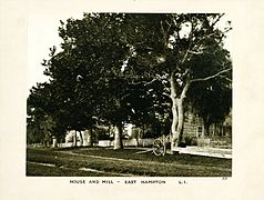 House and Mill, East Hampton, Long Island, c. 1872-1887. George Bradford Brainerd, Brooklyn Museum
 -
 Blacksmith Shop, East Hampton, Long Island, c. 1872-1887. George Bradford Brainerd, Brooklyn Museum
 -
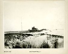 Along Beach, East Hampton, Long Island, c. 1872-1887. George Bradford Brainerd, Brooklyn Museum
 -
 Academy, East Hampton, Long Island, c. 1872-1887
 -
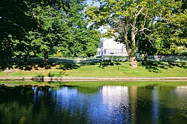 Town Pond at the white house
 -
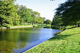 Town Pond
 -
 Gardiner Windmill
 -
 Pantigo Windmill
 -
 Hook Mill


_6913.jpg)

Whaling

While East Hampton was developed originally for agriculture, the settlers soon discovered that whales frequently beached along the South shore of the town. The whales could be carved up for food and oil. Town laws were written to regulate the proper handling of such carcasses. As the demand for whale products grew, residents became more aggressive in their harvesting techniques. No longer content to settle for harvesting beached whales, they began harvesting live whales that were coming near shore.
Northwest Harbor, located at Northwest Landing on Gardiner's Bay, was the town's first harbor. The harbor turned out to be too shallow for large ships, so a larger port was developed two miles (3 km) West, at Sag Harbor. Some accounts say that it was named because of its relation to the settlement of Sagaponack, New York in the Town of Southampton.[citation needed]
At the peak of the whaling industry, in 1847, some 60 whale ships were based in Sag Harbor, employing 800 men in related businesses. Herman Melville made numerous references to this village in his novel, Moby-Dick. The port rivaled that of New York.[citation needed] After 1847 the whaling industry dropped off dramatically because of the rise of alternative fuel products.
Among the sea captains of Sag Harbor were ancestors of politician Howard Dean, who was born in East Hampton.[17]
The most famous voyages out of Sag Harbor were those by Mercator Cooper. In 1845 he was on an American ship that picked up shipwrecked Japanese sailors in the Bonin Islands and returned them to Tokyo. In 1853 Cooper traveled with an expedition to the far South, where he broke through the ice shelf to become the first person to touch East Antarctica.[citation needed]
The Town of East Hampton is still highly influenced by maritime businesses, including tourism. It attracts large summer crowds of residents and tourists. Montauk is New York state's largest fishing port.[18] The Town is famed for its commercial sports fishing, made particularly famous by Frank Mundus. One of the largest buildings in the town is the Promised Land fish meal factory at Napeague.
Presidents and First Ladies
First Ladies Julia Gardiner Tyler and Jacqueline Bouvier Kennedy Onassis spent their childhoods there. Theodore Roosevelt was briefly quarantined in Montauk, at Camp Wyckoff, after returning from the Spanish–American War. Bill and Hillary Clinton spent week-long summer vacations in 1998 and 1999.
Julia Gardiner Tyler

Julia Gardiner was born on Gardiners Island and her father had a house in East Hampton village. On February 28, 1844, she and her father, David Gardiner, were part of the Presidential party aboard the USS Princeton when a malfunctioning cannon exploded. Her father and two Cabinet officers were killed. According to legend Julia fainted into the arms of President John Tyler (who had earlier lost his first wife). They married four months later, creating a national scandal, since there was a 30-year difference in their ages.
Zdroj:https://en.wikipedia.org?pojem=East_Hampton_(town),_New_York
Text je dostupný za podmienok Creative Commons Attribution/Share-Alike License 3.0 Unported; prípadne za ďalších podmienok. Podrobnejšie informácie nájdete na stránke Podmienky použitia.
Antropológia
Aplikované vedy
Bibliometria
Dejiny vedy
Encyklopédie
Filozofia vedy
Forenzné vedy
Humanitné vedy
Knižničná veda
Kryogenika
Kryptológia
Kulturológia
Literárna veda
Medzidisciplinárne oblasti
Metódy kvantitatívnej analýzy
Metavedy
Metodika
Text je dostupný za podmienok Creative
Commons Attribution/Share-Alike License 3.0 Unported; prípadne za ďalších
podmienok.
Podrobnejšie informácie nájdete na stránke Podmienky
použitia.
www.astronomia.sk | www.biologia.sk | www.botanika.sk | www.dejiny.sk | www.economy.sk | www.elektrotechnika.sk | www.estetika.sk | www.farmakologia.sk | www.filozofia.sk | Fyzika | www.futurologia.sk | www.genetika.sk | www.chemia.sk | www.lingvistika.sk | www.politologia.sk | www.psychologia.sk | www.sexuologia.sk | www.sociologia.sk | www.veda.sk I www.zoologia.sk