A | B | C | D | E | F | G | H | CH | I | J | K | L | M | N | O | P | Q | R | S | T | U | V | W | X | Y | Z | 0 | 1 | 2 | 3 | 4 | 5 | 6 | 7 | 8 | 9
Jammu and Kashmir | |
|---|---|
 Interactive map of Jammu and Kashmir | |
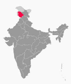 Jammu and Kashmir with disputed territories | |
| Coordinates: 33°5′24″N 74°47′24″E / 33.09000°N 74.79000°E | |
| Administering state | India |
| Union territory | 31 October 2019 |
| Capitals | Srinagar (May–October) Jammu (November–April)[4] |
| Districts | 20 |
| Government | |
| • Body | Government of Jammu and Kashmir |
| • Lieutenant Governor | Manoj Sinha |
| • National Parliament | Parliament of India : Lok Sabha (5) |
| • High Court | High Court of Jammu and Kashmir and Ladakh |
| Area | |
| • Total | 42,241 km2 (16,309 sq mi) |
| Highest elevation | 7,135 m (23,409 ft) |
| Lowest elevation | 247 m (810 ft) |
| Population (2011)[6] | |
| • Total | 12,267,013 |
| • Density | 290/km2 (750/sq mi) |
| Languages | |
| • Official | Kashmiri, Dogri, Urdu, Hindi, English[7][8] |
| • Spoken | Kashmiri, Gojri, Pahari, Punjabi, Bhadarwahi, Sarazi, Khowar, Shina, Burushaski, Bateri[16] |
| Time zone | UTC+05:30 (IST) |
| ISO 3166 code | IN-JK |
| Vehicle registration | JK |
| HDI (2018) | |
| Website | www |
Jammu and Kashmir[b] is a region administered by India as a union territory[1] and consists of the southern portion of the larger Kashmir region, which has been the subject of a dispute between India and Pakistan since 1947 and between India and China since 1959.[3] The Line of Control separates Jammu and Kashmir from the Pakistani-administered territories of Azad Kashmir and Gilgit-Baltistan in the west and north. It lies to the north of the Indian states of Himachal Pradesh and Punjab and to the west of Ladakh which is administered by India as a union territory.[2]
Provisions for the formation of the union territory of Jammu and Kashmir were contained within the Jammu and Kashmir Reorganisation Act, 2019, which was passed by both houses of the Parliament of India in August 2019. The act re-constituted the former state of Jammu and Kashmir into two union territories, one being Jammu and Kashmir and the other being Ladakh, with effect from 31 October 2019.[18]
Terminology
Jammu and Kashmir is named after the two regions it encompasses – the Jammu region and the Kashmir Valley. As per Government of India, Kashmir region encompasses the region under Indian control and the territory under Pakistan control known as "Pakistan-occupied Kashmir" (POK).[19][20] While Pakistan considers the Indian controlled territory as a part of "Indian-occupied Kashmir" (IOK) or "Indian-held Kashmir" (IHK),[21][22] neutral sources use "Indian-administered Kashmir"/"Pakistan-administered Kashmir" and "Indian-controlled Kashmir"/"Pakistan-controlled Kashmir" to demarcate the areas.[23]
History
The state of Jammu and Kashmir was accorded special status by Article 370 of the Constitution of India. In contrast to other states of India, Jammu and Kashmir had its own constitution, flag, and administrative autonomy.[24] Indian citizens from other states were not allowed to purchase land or property in Jammu and Kashmir.[25]
Jammu and Kashmir had three distinct areas: Hindu-majority Jammu region, Muslim-majority Kashmir Valley, and Buddhist-dominated Ladakh.[26] Unrest and violence persisted in the Kashmiri Valley and, following a disputed state election in 1987, an insurgency persisted in protest over autonomy and rights.[26][27]
The Bharatiya Janata Party (BJP) came to power in the 2014 Indian general election and five years later included in their 2019 election manifesto the revocation of Article 370 of the Constitution of India, in order to bring Jammu and Kashmir to equal status with other states.[26]
A resolution to repeal Article 370 was passed by both the houses of the Parliament of India in August 2019. At the same time, a reorganisation act was also passed, which would reconstitute the state into two union territories, Jammu and Kashmir and Ladakh.[28] The reorganisation took effect from 31 October 2019.[18]
In September 2019, nearly 4,000 people, including two former Chief Ministers and hundreds of other politicians, were arrested by the Indian authorities in Kashmir;[29] the state was put under a lockdown and communication and internet services were suspended.[30][31]
Geography
Topography
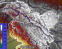
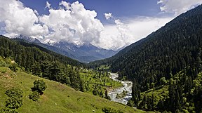
Jammu and Kashmir is home to several valleys such as the Kashmir Valley, Tawi Valley, Chenab Valley, Poonch Valley, Sind Valley, and Lidder Valley.[32] The Kashmir valley is 100 km (62 mi) wide and 15,520.3 km2 (5,992.4 sq mi) in area.[33] The Himalayas divide the Kashmir valley from the Tibetan plateau while the Pir Panjal range, which encloses the valley from the west and the south, separates it from the Punjab Plain of the Indo-Gangetic Plain.[34] Along the northeastern flank of the Valley runs the main range of the Himalayas.[35] This valley has an average height of 1,850 metres (6,070 ft) above sea-level,[33] but the surrounding Pir Panjal range has an average elevation of 10,000 feet (3,000 m).[36] The Jhelum River is the major Himalayan river which flows through the Kashmir valley.[37] The southern Jammu region is mostly mountainous, with the Shivaliks, the middle and the great Himalayas running parallel to each other in a southeast–northwest direction. A narrow southwestern strip constitutes fertile plains. The Chenab, Tawi and Ravi are important rivers flowing through the Jammu region.[38]

Climate
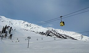
The climate of Jammu and Kashmir varies with altitude and across regions. Southern and southwestern areas have a sub tropical climate, with hot summers and cool winters. This region receives most of its rainfall during the monsoon season. In the east and north, summers are usually pleasant. The effect of the monsoon diminishes in areas lying to the leeward side of the Pir Panjal, such as the Kashmir valley, and much of the rainfall happens in the spring season due to western disturbances. Winters are cold, with temperatures reaching sub-zero levels. Snowfall is common in the valley and the mountain areas.
Administrative divisions

The union territory of Jammu and Kashmir consists of two divisions: Jammu Division and Kashmir Division, and is further divided into 20 districts.[39]
| Division | Name | Headquarters | Area (km2) |
Area (sq miles) |
Rural Area (km2) |
Urban Area (km2) |
|
|---|---|---|---|---|---|---|---|
| Jammu | Kathua district | Kathua | 2,502 | 966 | 2,458.84 | 43.16 | [40] |
| Jammu district | Jammu | 2,342 | 904 | 2,089.87 | 252.13 | [41] | |
| Samba district | Samba | 904 | 349 | 865.24 | 38.76 | [42] | |
| Udhampur district | Udhampur | 2,637 | 1,018 | 2,593.28 | 43.72 | [43] | |
| Reasi district | Reasi | 1,719 | 664 | 1,679.99 | 39.01 | [44] | |
| Rajouri district | Rajouri | 2,630 | 1,015 | 2,608.11 | 21.89 | [45] | |
| Poonch district | Poonch | 1,674 | 646 | 1,649.92 | 24.08 | [46] | |
| Doda district | Doda | 8,912 | 3,441 | 8,892.25 | 19.75 | [47] | |
| Ramban district | Ramban | 1,329 | 513 | 1,313.92 | 15.08 | [48] | |
| Kishtwar district | Kishtwar | 1,644 | 635 | 1,643.37 | 0.63 | [49] | |
| Total for division | 26,293 | 10,151 | 25,794.95 | 498.05 | |||
| Kashmir | Anantnag district | Anantnag | 3,574 | 1,380 | 3,475.76 | 98.24 | [50] |
| Kulgam district | Kulgam | 410 | 158 | 360.20 | 49.80 | [51] | |
| Pulwama district | Pulwama | 1,086 | 419 | 1,047.45 | 38.55 | [52] | |
| Shopian district | Shopian | 312 | 120 | 306.56 | 5.44 | [53] | |
| Budgam district | Budgam | 1,361 | 525 | 1,311.95 | 49.05 | [54] | |
| Srinagar district | Srinagar | 1,979 | 764 | 1,684.42 | 294.53 | [55] | |
| Ganderbal district | Ganderbal | 259 | 100 | 233.60 | 25.40 | [56] | |
| Bandipora district | Bandipora | 345 | 133 | 295.37 | 49.63 | [57] | |
| Baramulla district | Baramulla | 4,243 | 1,638 | 4,179.44 | 63.56 | [58] | |
| Kupwara district | Kupwara | 2,379 | 919 | 2,331.66 | 47.34 | [59] | |
| Total for division | 15,948 | 6,156 | 15,226.41 | 721.54 | |||
Transport
Air
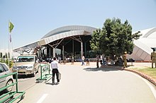
Jammu and Kashmir has two major airports at the two capitals of the territory: Jammu Airport at Jammu and Srinagar Airport at Srinagar, which is also the only international airport in the territory. These airports have regular flights to Delhi, Mumbai, Bangalore, Chandigarh and other major cities of the country.
Railway
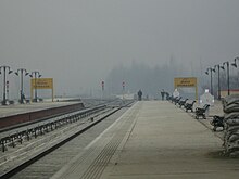
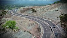
The under-construction Jammu-Baramulla line of the Northern Railways is the only railway line in the territory. Once complete, the line will connect the two regions of Jammu and Kashmir and will also provide a rail link to the Kashmir valley from other parts of the country.
Road
The Jammu–Srinagar National Highway, a segment of the NH44, is the main highway in the territory connecting the two capitals by road. National Highways 1, 144, 144A, 444, 501, 701 and 701A are the other NHs in the territory.
Demographics
As per the 2011 census, Jammu and Kashmir has a total population of 12,267,013. The sex ratio is 889 females per 1000 males. Around 924,485 (7.54%) of the population is scheduled caste and 1,275,106 (10.39%) belong to the scheduled tribes, mainly Gujjar, Bakerwal, and Gaddi. The SCs are mostly concentrated in the Jammu region. The region also has a minority Christian community.
Religion
Muslims constitute the majority of the population of Jammu and Kashmir with a large Hindu minority.[60] The Kashmir Division is predominantly Muslim (96.41%) with a small Hindu (2.45%) and Sikh (0.81%) population. Only 808 Kashmiri Hindu Pandit families remain in the valley after their forced displacement by Islamic militants.[61] Shias are mostly concentrated in the Budgam district, where they form about 30-40% of the population.[62][63]
The Jammu Division is predominantly Hindu (66%) with a significant Muslim population (30%). The Muslims form a majority in the Rajouri (63%), Poonch (90%), Doda (54%), Kishtwar (58%) and Ramban (71%) districts of Jammu, while the Hindus form a majority in Kathua (88%), Samba (86%), Jammu (84%) and Udhampur (88%) districts. Reasi district has an almost equal number of Hindus and Muslims.[64] The Dogras and various organisations of Hindu-majority Jammu region have demanded a separate state after bifurcation of the territory, on the basis of cultural, linguistic and religious differences from neighbouring Kashmiris (who are predominantly Muslim by faith).[65][66][67]
Language
Kashmiri is the most-spoken language, is mainly spoken in the Kashmir Valley and in the upper reaches of the Chenab Valley, with a sizeable number of speakers in Jammu City. Dogri, related to Punjabi and Pahari, is spoken throughout the plains areas of Jammu division, as well as in parts of the hills. The hill people speak several languages. In the Pir Panjal Range, bordering Pakistan-administered Kashmir, the main language is Pahari-Pothwari, a western variety of Punjabi, as well as Gojri, the language of the Gujjar tribe. In the eastern hills of Jammu division are spoken various Western Pahari languages such as Siraji and Bhaderwahi, which merge with the dialects of western Himachal Pradesh.[68] Urdu is also widely understood and spoken, particularly in the Kashmir region where it acts as the lingua franca alongside Kashmiri and also serves as a medium of instruction along with English, while Hindi is taught and understood in the southern areas of Jammu.[citation needed]
Education
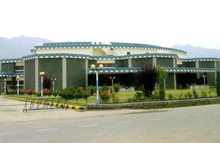
According to the 2011 census, the literacy rate in Jammu and Kashmir was 67.17%, male literacy was 75%, while female literacy was at 56.43%.
University of Kashmir located in Srinagar is the main university in the territory. Other universities include University of Jammu, Sher-e-Kashmir University of Agricultural Sciences and Technology of Kashmir, Shri Mata Vaishno Devi University, Islamic University of Science & Technology, etc. Major institutions of higher education are NIT Srinagar, IIT Jammu, IIM Jammu, NIFT Srinagar and IHM Srinagar. Medical colleges include SKIMS, and the Government Medical College in Srinagar and All India Institute of Medical Sciences, Vijaypur, Jammu.
Government and politics
The union territory of Jammu and Kashmir is administered under the provisions of Article 239 of the Constitution of India. Article 239A, originally formulated for the union territory of Puduchery, is also applicable to Jammu and Kashmir.[69]
Executive branch
The President of India appoints a Lieutenant Governor for the union territory.[69]
A Council of Ministers led by a Chief Minister is appointed by the Lieutenant Governor from the membership of the legislative assembly. Their role is to advise the Lieutenant Governor in the exercise of functions in matters under the jurisdiction of the legislative assembly. In other matters, the Lieutenant Governor is empowered to act in his own capacity.[69]
Legislative branch
The legislative branch of government is a unicameral legislative assembly, whose tenure is five years. The legislative assembly may make laws for any of the matters in the State List of the Constitution of India except "public order" and "police", which will remain the preserve of the central Government of India. The Lieutenant Governor also has the power to promulgate ordinances which have the same force as the acts of the legislative assembly.[69]
Elections for the Jammu and Kashmir Legislative Assembly are to be held to be expected in 2024 along with general election.[70]
Judicial branch
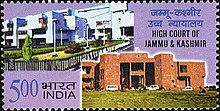
The union territory is under the jurisdiction of the Jammu and Kashmir High Court, which also serves as the high court for Ladakh.[69] Police services are provided by the Jammu and Kashmir Police.[71]
Parties
The main political parties active in the region are the Jammu & Kashmir National Conference (President: Farooq Abdullah) the Jammu and Kashmir People's Democratic Party (President: Mehbooba Mufti) the Bharatiya Janata Party (State President: Ravinder Raina), the Indian National Congress (State President: Ghulam Ahmad Mir), and the Jammu and Kashmir People's Conference (President: Sajjad Gani Lone). Other parties with a presence in the region include the Communist Party of India (Marxist), the Jammu and Kashmir National Panthers Party, and the Jammu and Kashmir Apni Party (President: Altaf Bukhari).
Jammu and Kashmir in the Parliament of India
Jammu and Kashmir sends five members (MPs) to the lower house of the Indian parliament (the Lok Sabha) and four members to the upper house (the Rajya Sabha).
- Lok Sabha constituencies in Jammu and Kashmir

