A | B | C | D | E | F | G | H | CH | I | J | K | L | M | N | O | P | Q | R | S | T | U | V | W | X | Y | Z | 0 | 1 | 2 | 3 | 4 | 5 | 6 | 7 | 8 | 9
Juneau County | |
|---|---|
 | |
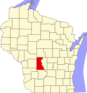
 Location within the U.S. state of Wisconsin | |
 Wisconsin's location within the U.S. | |
| Coordinates: 43°55′N 90°07′W / 43.92°N 90.11°W | |
| Country | |
| State | |
| Founded | 1857 |
| Named for | Solomon Juneau |
| Seat | Mauston |
| Largest city | Mauston |
| Area | |
| • Total | 804 sq mi (2,080 km2) |
| • Land | 767 sq mi (1,990 km2) |
| • Water | 37 sq mi (100 km2) 4.6% |
| Population | |
| • Total | 26,718 |
| • Density | 34.8/sq mi (13.4/km2) |
| Time zone | UTC−6 (Central) |
| • Summer (DST) | UTC−5 (CDT) |
| Congressional districts | 3rd, 7th |
| Website | www |
Juneau County is a county located in the U.S. state of Wisconsin. As of the 2020 census, the population was 26,718.[1] Its county seat is Mauston.[2]
History

Before white settlement, before loggers and explorers, the area that is now Juneau County was the home of Native Americans who left behind artifacts like the thunderbirds etched on the wall at Twin Bluffs[3] and the Gee's Slough mounds outside New Lisbon.[4]
Juneau County was established in 1857 when the Wisconsin Legislature passed legislation separating lands west of the Wisconsin River from what was then Adams County.[5] After a contest with neighboring New Lisbon, the county seat was established in Maugh's Town, which is known today as Mauston. The county was named after Solomon Juneau, a founder of Milwaukee.[6][7]
Geography
According to the U.S. Census Bureau, the county has a total area of 804 square miles (2,080 km2), of which 767 square miles (1,990 km2) is land and 37 square miles (96 km2) (4.6%) is water.[8]
Major highways
Railroads
Buses
Airports
- Necedah Airport (KDAF), serves the county and surrounding communities.
- Mauston–New Lisbon Union Airport (82C) enhances county service.
Adjacent counties
- Wood County - north
- Adams County - east
- Columbia County - southeast
- Sauk County - south
- Vernon County - southwest
- Monroe County - west
- Jackson County - northwest
National protected area
United States Military Posts
Fort McCoy outside of Juneau county
Demographics
| Census | Pop. | Note | %± |
|---|---|---|---|
| 1860 | 8,770 | — | |
| 1870 | 12,372 | 41.1% | |
| 1880 | 15,582 | 25.9% | |
| 1890 | 17,121 | 9.9% | |
| 1900 | 20,629 | 20.5% | |
| 1910 | 19,569 | −5.1% | |
| 1920 | 19,209 | −1.8% | |
| 1930 | 17,264 | −10.1% | |
| 1940 | 18,708 | 8.4% | |
| 1950 | 18,930 | 1.2% | |
| 1960 | 17,490 | −7.6% | |
| 1970 | 18,455 | 5.5% | |
| 1980 | 21,039 | 14.0% | |
| 1990 | 21,650 | 2.9% | |
| 2000 | 24,316 | 12.3% | |
| 2010 | 26,664 | 9.7% | |
| 2020 | 26,718 | 0.2% | |
| U.S. Decennial Census[9] 1790–1960[10] 1900–1990[11] 1990–2000[12] 2010[13] 2020[1] | |||
2020 census
As of the census of 2020,[1] the population was 26,718. The population density was 34.8 people per square mile (13.4 people/km2). There were 14,441 housing units at an average density of 18.8 units per square mile (7.3 units/km2). The racial makeup of the county was 90.9% White, 2.1% Black or African American, 1.4% Native American, 0.6% Asian, 0.9% from other races, and 4.1% from two or more races. Ethnically, the population was 2.7% Hispanic or Latino of any race.
2000 census
As of the census[14] of 2000, there were 24,316 people, 9,696 households, and 6,699 families residing in the county. The population density was 32 people per square mile (12 people/km2). There were 12,370 housing units at an average density of 16 units per square mile (6.2 units/km2). The racial makeup of the county was 96.61% White, 0.33% Black or African American, 1.30% Native American, 0.44% Asian, 0.02% Pacific Islander, 0.57% from other races, and 0.74% from two or more races. 1.43% of the population were Hispanic or Latino of any race. 41.2% were of German, 9.9% Irish, 8.8% Norwegian, 6.5% Polish and 5.8% English ancestry.
There were 9,696 households, out of which 30.4% had children under the age of 18 living with them, 55.5% were married couples living together, 8.8% had a female householder with no husband present, and 30.9% were non-families. 26.0% of all households were made up of individuals, and 12.30% had someone living alone who was 65 years of age or older. The average household size was 2.47 and the average family size was 2.96.
In the county, the population was spread out, with 25.4% under the age of 18, 6.9% from 18 to 24, 26.6% from 25 to 44, 24.3% from 45 to 64, and 16.8% who were 65 years of age or older. The median age was 39 years. For every 100 females there were 100.1 males. For every 100 females age 18 and over, there were 97.4 males.
In 2017, there were 282 births, giving a general fertility rate of 72.7 births per 1000 women aged 15–44, the 12th highest rate out of all 72 Wisconsin counties. Of these, only 2 of the births occurred at home.[15] Additionally, there were 16 reported induced abortions performed on women of Juneau County residence in 2017, a figure higher than the records for the preceding four years.[16]
Communities


Cities
- Elroy
- Mauston (county seat)
- New Lisbon
- Wisconsin Dells (mostly in Columbia County, Adams County, and Sauk County)
Villages
Towns
Unincorporated communities
Politics
| Year | Republican | Democratic | Third party | |||
|---|---|---|---|---|---|---|
| No. | % | No. | % | No. | % | |
| 2020 | 8,749 | 63.82% | 4,746 | 34.62% | 214 | 1.56% |
| 2016 | 7,130 | 60.76% | 4,073 | 34.71% | 532 | 4.53% |
| 2012 | 5,411 | 45.75% | 6,242 | 52.78% | 174 | 1.47% |
| 2008 | 5,148 | 44.65% | 6,186 | 53.65% | 196 | 1.70% |
| 2004 | 6,473 | 52.29% | 5,734 | 46.32% | 172 | 1.39% |
| 2000 | 4,910 | 48.05% | 4,813 | 47.10% | 495 | 4.84% |
| 1996 | 3,226 | 35.13% | 4,331 | 47.17% | 1,625 | 17.70% |
| 1992 | 4,051 | 36.85% | 4,177 | 38.00% | 2,765 | 25.15% |
| 1988 | 4,869 | 56.21% | 3,734 | 43.11% | 59 | 0.68% |
| 1984 | 5,629 | 63.62% | 3,152 | 35.62% | 67 | 0.76% |
| 1980 | 5,591 | 55.14% | 3,884 | 38.30% | 665 | 6.56% |
| 1976 | 4,242 | 46.73% | 4,512 | 49.71% | 323 | 3.56% |
| 1972 | 4,833 | 60.19% | 2,943 | 36.65% | 254 | 3.16% |
| 1968 | 3,828 | 53.60% | 2,595 | 36.33% | 719 | 10.07% |
| 1964 | 2,976 | 39.33% | 4,583 | 60.57% | 8 | 0.11% |
| 1960 | 4,997 | 60.60% | 3,238 | 39.27% | 11 | 0.13% |
| 1956 | 5,135 | 67.58% | 2,428 | 31.96% | 35 | 0.46% |
| 1952 | 5,978 | 73.22% | 2,163 | 26.49% | 23 | 0.28% |
| 1948 | 3,793 | 55.71% | 2,889 | 42.43% | 127 | 1.87% |
| 1944 | 4,733 | 61.97% | 2,857 | 37.41% | 47 | 0.62% |
| 1940 | 5,268 | 60.51% | 3,354 | 38.53% | 84 | 0.96% |
| 1936 | 3,084 | 37.83% | 4,544 | 55.74% | 524 | 6.43% |
| 1932 | 2,018 | 29.37% | 4,723 | 68.75% | 129 | 1.88% |
| 1928 | 3,777 | 57.74% | 2,708 | 41.40% | 56 | 0.86% |
| 1924 | 1,917 | 31.10% | 403 | 6.54% | Zdroj:https://en.wikipedia.org?pojem=Juneau_County,_Wisconsin||

