
A | B | C | D | E | F | G | H | CH | I | J | K | L | M | N | O | P | Q | R | S | T | U | V | W | X | Y | Z | 0 | 1 | 2 | 3 | 4 | 5 | 6 | 7 | 8 | 9

There are 88 counties in the U.S. state of Ohio. Nine of them existed at the time of the Ohio Constitutional Convention in 1802.[1] A tenth county, Wayne, was established on August 15, 1796, and encompassed roughly the present state of Michigan.[2] During the Convention, the county was opposed to statehood, and was not only left out of the Convention, but dissolved; the current Wayne County is in northeastern Ohio, considerably distant from the area that was the original Wayne County.[1]
The Ohio Constitution allows counties to set up a charter government as many cities and villages do,[3] but only Summit and Cuyahoga counties have done so,[4] the latter having been approved by voters in November 2009.[5] Counties do not possess home rule powers and can do only what has been expressly authorized by the Ohio General Assembly. The elected county officials in Ohio county governments include three commissioners, a sheriff (the highest law enforcement officer in the county); prosecutor (equivalent of a district attorney in other states); coroner, engineer, Recorder, auditor, treasurer, and clerk of courts.[6][7]
Population figures are based on the 2023 vintage Census population estimates. The population of Ohio was 11,785,935 at that time, a decrease of 0.1% from 2020. The average population of Ohio's counties was 133,931; Franklin County was the most populous (1,326,063) and Vinton County was the least (12,474). The average land area is 464 sq mi (1,200 km2). The largest county by area is Ashtabula County at 702.44 sq mi (1,819.3 km2), and its neighbor, Lake County, is the smallest at 228.21 sq mi (591.1 km2). The total area of the state is 40,860.69 sq mi (105,828.7 km2).[8][9]
List of counties
| County |
FIPS code[10] | County Seat[11] | Est.[12] | Origin[13] | Etymology[12][13] | Population (2023)[10][11][14] |
Area[11] | Map |
|---|---|---|---|---|---|---|---|---|
| Adams County | 001 | West Union | Jul 10, 1797 | Hamilton County | John Adams (1735–1826), President of the United States when the county was organized | 27,521 | 583.91 sq mi (1,512 km2) |

|
| Allen County | 003 | Lima | Mar 1, 1820 | Shelby County | John Allen (1771/2-1813), a War of 1812 colonel[15] | 100,838 | 404.43 sq mi (1,047 km2) |

|
| Ashland County | 005 | Ashland | Feb 24, 1846 | Wayne, Richland, Huron, and Lorain Counties | Ashland, home of U.S. Senator from Kentucky Henry Clay | 52,190 | 424.37 sq mi (1,099 km2) |

|
| Ashtabula County | 007 | Jefferson | Jun 7, 1807 | Trumbull and Geauga Counties | Ashtabula River, which means "fish river" in an Algonquian language[16] | 96,845 | 702.44 sq mi (1,819 km2) |

|
| Athens County | 009 | Athens | Mar 1, 1805 | Washington County | Athens in Greece | 62,706 | 506.76 sq mi (1,313 km2) |

|
| Auglaize County | 011 | Wapakoneta | Feb 14, 1848 | Allen, Mercer, Darke, Hardin, Logan, Shelby, and Van Wert Counties | Auglaize River, which means "fallen timbers river" in the Shawnee Indian language | 46,050 | 401.25 sq mi (1,039 km2) |

|
| Belmont County | 013 | St. Clairsville | Sep 7, 1801 | Jefferson and Washington Counties | French for "beautiful mountain" | 64,918 | 537.35 sq mi (1,392 km2) |

|
| Brown County | 015 | Georgetown | Mar 1, 1818 | Adams and Clermont Counties | General Jacob Brown (1775–1828), an officer of the War of 1812 | 43,777 | 491.76 sq mi (1,274 km2) |

|
| Butler County | 017 | Hamilton | May 1, 1803 | Hamilton County | General Richard Butler (1743–1791), killed at the Battle of the Wabash | 393,043 | 467.27 sq mi (1,210 km2) |

|
| Carroll County | 019 | Carrollton | Jan 1, 1833 | Columbiana, Stark, Harrison, Jefferson, and Tuscarawas Counties | Charles Carroll (1737–1832), last surviving signer of the United States Declaration of Independence | 26,758 | 394.67 sq mi (1,022 km2) |

|
| Champaign County | 021 | Urbana | Mar 1, 1805 | Greene and Franklin Counties | French for "a plain", describing the land in the area | 38,845 | 428.56 sq mi (1,110 km2) |

|
| Clark County | 023 | Springfield | Mar 1, 1818 | Champaign, Madison, and Greene Counties | General George Rogers Clark (1752–1818), defeated the Shawnee Indians in a battle near the Springfield area | 134,610 | 399.86 sq mi (1,036 km2) |

|
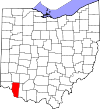
| Clermont County | 025 | Batavia | Dec 6, 1800 | Hamilton County | French for "clear mountain" | 211,972 | 451.99 sq mi (1,171 km2) |
|
| Clinton County | 027 | Wilmington | Mar 1, 1810 | Highland and Warren Counties | George Clinton (1739–1812), vice-president when the county was organized | 41,938 | 410.88 sq mi (1,064 km2) |

|
| Columbiana County | 029 | Lisbon | May 1, 1803 | Jefferson and Washington Counties | Christopher Columbus, European explorer of the Americas | 100,182 | 532.46 sq mi (1,379 km2) |

|
| Coshocton County | 031 | Coshocton | Jan 31, 1810 | Muskingum and Tuscarawas Counties | Delaware Indian word meaning "union of waters" | 36,869 | 564.07 sq mi (1,461 km2) |

|
| Crawford County | 033 | Bucyrus | Apr 1, 1820 | Delaware County | Colonel William Crawford (1732–1782), Revolutionary War officer | 41,529 | 402.11 sq mi (1,041 km2) |

|
| Cuyahoga County | 035 | Cleveland | Jun 7, 1807 | Geauga County | Cuyahoga River, which means "crooked river" in an Iroquoian language[17] | 1,233,088 | 458.49 sq mi (1,187 km2) |

|
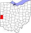
| Darke County | 037 | Greenville | Jan 3, 1809 | Miami County | General William Darke (1736–1801), Revolutionary War officer | 51,415 | 599.80 sq mi (1,553 km2) |
|
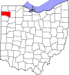
| Defiance County | 039 | Defiance | Apr 7, 1845 | Williams, Henry, and Paulding Counties | Fort Defiance, built in 1794 by General Anthony Wayne | 38,315 | 411.16 sq mi (1,065 km2) |
|
| Delaware County | 041 | Delaware | Apr 1, 1808 | Franklin County | Delaware Indians | 231,636 | 442.41 sq mi (1,146 km2) |

|
| Erie County | 043 | Sandusky | Mar 15, 1838 | Huron and Sandusky Counties | Erie Indians | 74,035 | 254.88 sq mi (660 km2) |

|
| Fairfield County | 045 | Lancaster | Dec 9, 1800 | Ross and Washington Counties | Named for the beauty of its "fair fields" | 165,360 | 505.11 sq mi (1,308 km2) |

|
| Fayette County | 047 | Washington Court House | Mar 1, 1810 | Ross and Highland Counties | Gilbert du Motier, marquis de La Fayette, French military officer and aristocrat who participated in both the American and French revolutions | 28,817 | 406.58 sq mi (1,053 km2) |

|
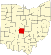
| Franklin County | 049 | Columbus | Apr 30, 1803 | Ross and Wayne Counties | Benjamin Franklin (1706–1791), Founding Father, author, printer, political theorist, scientist, inventor, and statesman | 1,326,063 | 539.87 sq mi (1,398 km2) |
|
| Fulton County | 051 | Wauseon | Apr 1, 1850 | Lucas, Henry, and Williams Counties | Robert Fulton (1765–1815), inventor of the steamboat[18] | 42,007 | 406.78 sq mi (1,054 km2) |

|
| Gallia County | 053 | Gallipolis | Apr 30, 1803 | Washington and Adams Counties | Gaul, the ancient name of France | 28,986 | 468.78 sq mi (1,214 km2) |

|
| Geauga County | 055 | Chardon | Mar 1, 1806 | Trumbull County | An Indian word meaning "raccoon" | 95,407 | 403.66 sq mi (1,045 km2) |

|
| Greene County | 057 | Xenia | May 1, 1803 | Hamilton and Ross Counties | General Nathanael Greene (1742–1786), Revolutionary War officer | 169,691 | 414.88 sq mi (1,075 km2) |

|
| Guernsey County | 059 | Cambridge | Mar 1, 1810 | Belmont and Muskingum Counties | Island of Guernsey, from where most of the settlers originated | 38,089 | 521.90 sq mi (1,352 km2) |

|
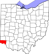
| Hamilton County | 061 | Cincinnati | Jan 2, 1790 | One of the original counties | Alexander Hamilton (1755/7-1804), Secretary of the Treasury when the county was organized | 827,058 | 407.36 sq mi (1,055 km2) |
|
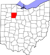
| Hancock County | 063 | Findlay | Apr 1, 1820 | Logan County | John Hancock (1737–1793), president of the Continental Congress | 74,704 | 531.35 sq mi (1,376 km2) |
|
| Hardin County | 065 | Kenton | Apr 1, 1820 | Logan County | General John Hardin (1753–1792), Revolutionary War officer | 30,368 | 470.29 sq mi (1,218 km2) |

|
| Harrison County | 067 | Cadiz | Feb 1, 1813 | Jefferson and Tuscarawas Counties | General William Henry Harrison (1773–1841), an officer of the War of 1812 and future President of the United States | 14,159 | 403.53 sq mi (1,045 km2) |

|
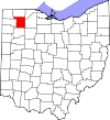
| Henry County | 069 | Napoleon | Apr 1, 1820 | Shelby County | Patrick Henry (1736–1799), Revolutionary War-era legislator, orator, and scholar | 27,520 | 416.50 sq mi (1,079 km2) |
|
| Highland County | 071 | Hillsboro | May 1, 1805 | Ross, Adams, and Clermont Counties | Descriptive of the county's terrain | 43,614 | 553.28 sq mi (1,433 km2) |

|
| Hocking County | 073 | Logan | Mar 1, 1818 | Athens, Ross, and Fairfield Counties | Possibly derived from the Delaware Indian word "Hoch-Hoch-ing", meaning "bottle" | 27,540 | 422.75 sq mi (1,095 km2) |

|
| Holmes County | 075 | Millersburg | Jan 20, 1824 | Coshocton, Wayne, and Tuscarawas Counties | Major Andrew Holmes (died 1814), a War of 1812 officer | 44,386 | 422.99 sq mi (1,096 km2) |

|
| Huron County | 077 | Norwalk | Mar 7, 1809 | Portage and Cuyahoga Counties | Huron Indians | 58,199 | 492.69 sq mi (1,276 km2) |

|
| Jackson County | 079 | Jackson | Mar 1, 1816 | Scioto, Gallia, Athens, and Ross Counties | General Andrew Jackson (1767–1845), future President of the United States | 32,606 | 420.28 sq mi (1,089 km2) |

|
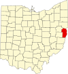
| Jefferson County | 081 | Steubenville | Jul 29, 1797 | Washington County | Thomas Jefferson (1743–1826), Vice President when the county was organized, future President of the United States, and principal author of the Declaration of Independence | 64,026 | 409.61 sq mi (1,061 km2) |
|
| Knox County | 083 | Mount Vernon | Mar 1, 1808 | Fairfield County | General Henry Knox, the first Secretary of War | 63,320 | 527.12 sq mi (1,365 km2) |

|
| Lake County | 085 | Painesville | Mar 6, 1840 | Geauga and Cuyahoga Counties | Its location on Lake Erie | 231,640 | 228.21 sq mi (591 km2) |

|
| Lawrence County | 087 | Ironton | Dec 21, 1815 | Gallia and Scioto Counties | Captain James Lawrence (1781–1813), naval hero in the War of 1812 | 56,118 | 454.96 sq mi (1,178 km2) |

|
| Licking County | 089 | Newark | Mar 1, 1808 | Fairfield County | Licking River, named for the salt licks in the area, or an English pronunciation of the Lenape word W'li/'ik'/nk meaning "where the flood waters recede"[19] | 183,201 | 686.50 sq mi (1,778 km2) |
|
| Logan County | 091 | Bellefontaine | Mar 1, 1818 | Champaign County | General Benjamin Logan (c. 1742 – 1802), who destroyed Shawnee Indian towns in the county | 46,057 | 458.44 sq mi (1,187 km2) |

|
| Lorain County | 093 | Elyria | Dec 26, 1822 | Huron, Cuyahoga, and Medina Counties | Province of Lorraine, France | 317,910 | 492.50 sq mi (1,276 km2) |

|
| Lucas County | 095 | Toledo | Jun 20, 1835 | Wood, Sandusky, and Huron Counties | Robert Lucas (1781–1853), Governor of Ohio when the county was created | 425,484 | 340.46 sq mi (882 km2) |

|
| Madison County | 097 | London | Mar 1, 1810 | Franklin County | James Madison (1751–1836), fourth President of the United States | 44,602 | 465.44 sq mi (1,205 km2) |

|
| Mahoning County | 099 | Youngstown | Mar 1, 1846 | Columbiana and Trumbull Counties | Mahoning River, from a Lenape word meaning "at the licks" | 225,596 | 415.25 sq mi (1,075 km2) |

|
| Marion County | 101 | Marion | Apr 1, 1820 | Delaware County | General Francis Marion (1732–1795), lieutenant colonel in the Continental Army and later brigadier general in the American Revolutionary War | Zdroj:https://en.wikipedia.org?pojem=List_of_counties_in_Ohio
