A | B | C | D | E | F | G | H | CH | I | J | K | L | M | N | O | P | Q | R | S | T | U | V | W | X | Y | Z | 0 | 1 | 2 | 3 | 4 | 5 | 6 | 7 | 8 | 9
| Potomac River | |
|---|---|
 | |
 The Potomac River watershed covers the District of Columbia and parts of four states | |
| Native name | Patawomeck (Algonquian languages) |
| Location | |
| Country | United States |
| State | West Virginia, Maryland, Virginia, District of Columbia |
| Cities | Cumberland, MD; Harpers Ferry, WV; Washington, D.C.; Alexandria, VA |
| Physical characteristics | |
| Source | North Branch |
| • location | Fairfax Stone, Preston County, West Virginia |
| • coordinates | 39°11′43″N 79°29′28″W / 39.19528°N 79.49111°W |
| • elevation | 3,060 ft (930 m) |
| 2nd source | South Branch |
| • location | Near Monterey, Highland County, Virginia |
| • coordinates | 38°25′30″N 79°36′27″W / 38.425°N 79.6075°W |
| Source confluence | |
| • location | Green Spring, West Virginia |
| • coordinates | 39°31′39″N 78°35′15″W / 39.5275°N 78.5875°W |
| Mouth | Chesapeake Bay |
• location | St. Mary's County, Maryland/Northumberland County, Virginia, United States |
• coordinates | 38°00′00″N 76°20′06″W / 38°N 76.335°W |
• elevation | 0 ft (0 m) |
| Length | 405 mi (652 km) |
| Basin size | 14,700 sq mi (38,000 km2) |
| Discharge | |
| • location | Little Falls, near Washington, D.C. (non-tidal; water years: 1931–2018)[2] |
| • average | 11,498 cu ft/s (325.6 m3/s) (1931–2018) |
| • minimum | 4,017 cu ft/s (113.7 m3/s) (2002) |
| • maximum | 484,000 cu ft/s (13,700 m3/s) (1936) |
| Discharge | |
| • location | Point of Rocks, Maryland |
| • average | 9,504 cu ft/s (269.1 m3/s) |
| Discharge | |
| • location | Hancock, Maryland |
| • average | 4,168 cu ft/s (118.0 m3/s) |
| Discharge | |
| • location | Paw Paw, West Virginia |
| • average | 3,376 cu ft/s (95.6 m3/s) |
| Basin features | |
| Tributaries | |
| • left | Conococheague Creek, Antietam Creek, Monocacy River, Rock Creek, Anacostia River |
| • right | Cacapon River, Shenandoah River, Goose Creek, Occoquan River, Wicomico River |
| Waterfalls | Great Falls, Little Falls |
| ------------------------------------------------------------------ Note: Since 1996, the Potomac has been the 'sister river' of the Ara River of Tokyo, Japan[3] | |
The Potomac River (/pəˈtoʊmək/ ) is a major river in the Mid-Atlantic region of the United States that flows from the Potomac Highlands in West Virginia to the Chesapeake Bay in Maryland. It is 405 miles (652 km) long,[4] with a drainage area of 14,700 square miles (38,000 km2),[5] and is the fourth-largest river along the East Coast of the United States and the 21st-largest in the United States. More than 5 million people live within its watershed.
The river forms part of the borders between Maryland and Washington, D.C., on the left descending bank, and West Virginia and Virginia on the right descending bank. Except for a small portion of its headwaters in West Virginia, the North Branch Potomac River is considered part of Maryland to the low-water mark on the opposite bank. The South Branch Potomac River lies completely within the state of West Virginia except for its headwaters, which lie in Virginia.
Course

The Potomac River runs 405 mi (652 km) from Fairfax Stone Historical Monument State Park in West Virginia on the Allegheny Plateau to Point Lookout, Maryland, and drains 14,679 sq mi (38,020 km2). The length of the river from the junction of its North and South Branches to Point Lookout is 302 mi (486 km).[4]

The river has two sources. The source of the North Branch is at the Fairfax Stone located at the junction of Grant, Tucker, and Preston counties in West Virginia. The source of the South Branch is located near Hightown in northern Highland County, Virginia. The river's two branches converge just east of Green Spring in Hampshire County, West Virginia, to form the Potomac. As it flows from its headwaters down to the Chesapeake Bay, the Potomac traverses five geological provinces: the Appalachian Plateau, the Ridge and Valley, the Blue Ridge, the Piedmont Plateau, and the Atlantic coastal plain.
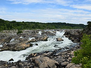
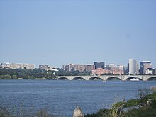
Once the Potomac drops from the Piedmont to the Coastal Plain at the Atlantic Seaboard fall line at Little Falls, tides further influence the river as it passes through Washington, D.C., and beyond. Salinity in the Potomac River Estuary increases thereafter with distance downstream. The estuary also widens, reaching 11 statute miles (17 km) wide at its mouth, between Point Lookout, Maryland, and Smith Point, Virginia, before flowing into the Chesapeake Bay.

