
A | B | C | D | E | F | G | H | CH | I | J | K | L | M | N | O | P | Q | R | S | T | U | V | W | X | Y | Z | 0 | 1 | 2 | 3 | 4 | 5 | 6 | 7 | 8 | 9
| Part of a series on |
| Weather |
|---|
|
|
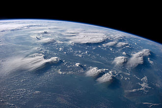
In meteorology, a cloud is an aerosol consisting of a visible mass of miniature liquid droplets, frozen crystals, or other particles suspended in the atmosphere of a planetary body or similar space.[1] Water or various other chemicals may compose the droplets and crystals. On Earth, clouds are formed as a result of saturation of the air when it is cooled to its dew point, or when it gains sufficient moisture (usually in the form of water vapor) from an adjacent source to raise the dew point to the ambient temperature.
Clouds are seen in the Earth's homosphere, which includes the troposphere, stratosphere, and mesosphere. Nephology is the science of clouds, which is undertaken in the cloud physics branch of meteorology. There are two methods of naming clouds in their respective layers of the homosphere, Latin and common name.
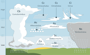
Genus types in the troposphere, the atmospheric layer closest to Earth's surface, have Latin names because of the universal adoption of Luke Howard's nomenclature that was formally proposed in 1802. It became the basis of a modern international system that divides clouds into five physical forms which can be further divided or classified into altitude levels to derive ten basic genera. The main representative cloud types for each of these forms are stratiform, cumuliform, stratocumuliform, cumulonimbiform, and cirriform. Low-level clouds do not have any altitude-related prefixes. However mid-level stratiform and stratocumuliform types are given the prefix alto- while high-level variants of these same two forms carry the prefix cirro-. In both cases, strato- is dropped from the latter form to avoid double-prefixing. Genus types with sufficient vertical extent to occupy more than one level do not carry any altitude-related prefixes. They are classified formally as low- or mid-level depending on the altitude at which each initially forms, and are also more informally characterized as multi-level or vertical. Most of the ten genera derived by this method of classification can be subdivided into species and further subdivided into varieties. Very low stratiform clouds that extend down to the Earth's surface are given the common names fog and mist, but have no Latin names.
In the stratosphere and mesosphere, clouds have common names for their main types. They may have the appearance of stratiform veils or sheets, cirriform wisps, or stratocumuliform bands or ripples. They are seen infrequently, mostly in the polar regions of Earth. Clouds have been observed in the atmospheres of other planets and moons in the Solar System and beyond. However, due to their different temperature characteristics, they are often composed of other substances such as methane, ammonia, and sulfuric acid, as well as water.
Tropospheric clouds can have a direct effect on climate change on Earth. They may reflect incoming rays from the Sun which can contribute to a cooling effect where and when these clouds occur, or trap longer wave radiation that reflects back up from the Earth's surface which can cause a warming effect. The altitude, form, and thickness of the clouds are the main factors that affect the local heating or cooling of the Earth and the atmosphere. Clouds that form above the troposphere are too scarce and too thin to have any influence on climate change. Clouds are the main uncertainty in climate sensitivity.[2]
Etymology
The origin of the term "cloud" can be found in the Old English words clud or clod, meaning a hill or a mass of stone. Around the beginning of the 13th century, the word came to be used as a metaphor for rain clouds, because of the similarity in appearance between a mass of rock and cumulus heap cloud. Over time, the metaphoric usage of the word supplanted the Old English weolcan, which had been the literal term for clouds in general.[3][4]
Homospheric nomenclatures and cross-classification
The table that follows is very broad in scope like the cloud genera template upon which it is partly based. There are some variations in styles of nomenclature between the classification scheme used for the troposphere (strict Latin except for surface-based aerosols) and the higher levels of the homosphere (common terms, some informally derived from Latin). However, the schemes presented here share a cross-classification of physical forms and altitude levels to derive the 10 tropospheric genera,[5] the fog and mist that forms at surface level, and several additional major types above the troposphere. The cumulus genus includes four species that indicate vertical size which can affect the altitude levels.
Form[6] Level[7] |
Stratiform non-convective |
Cirriform mostly non-convective |
Stratocumuliform limited-convective |
Cumuliform free-convective |
Cumulonimbiform strong-convective |
|---|---|---|---|---|---|
| Extreme-level | Noctilucent veils | Noctilucent billows or whirls | Noctilucent bands | ||
| Very high-level[8] | Nitric acid and water PSC veils | Cirriform nacreous PSC | Lenticular nacreous PSC | ||
| High-level | Cirrostratus | Cirrus | Cirrocumulus | ||
| Mid-level | Altostratus | Altocumulus | |||
| Towering vertical[9] | Cumulus congestus | Cumulonimbus | |||
| Multi-level or moderate vertical | Nimbostratus | Cumulus mediocris | |||
| Low-level | Stratus | Stratocumulus | Cumulus humilis or fractus | ||
| Surface-level | Fog or mist |
History of cloud science
Ancient cloud studies were not made in isolation, but were observed in combination with other weather elements and even other natural sciences. Around 340 BC, Greek philosopher Aristotle wrote Meteorologica, a work which represented the sum of knowledge of the time about natural science, including weather and climate. For the first time, precipitation and the clouds from which precipitation fell were called meteors, which originate from the Greek word meteoros, meaning 'high in the sky'. From that word came the modern term meteorology, the study of clouds and weather. Meteorologica was based on intuition and simple observation, but not on what is now considered the scientific method. Nevertheless, it was the first known work that attempted to treat a broad range of meteorological topics in a systematic way, especially the hydrological cycle.[10]
After centuries of speculative theories about the formation and behavior of clouds, the first truly scientific studies were undertaken by Luke Howard in England and Jean-Baptiste Lamarck in France. Howard was a methodical observer with a strong grounding in the Latin language, and used his background to formally classify the various tropospheric cloud types during 1802. He believed that scientific observations of the changing cloud forms in the sky could unlock the key to weather forecasting.
Lamarck had worked independently on cloud classification the same year and had come up with a different naming scheme that failed to make an impression even in his home country of France because it used unusually descriptive and informal French names and phrases for cloud types. His system of nomenclature included 12 categories of clouds, with such names as (translated from French) hazy clouds, dappled clouds, and broom-like clouds. By contrast, Howard used universally accepted Latin, which caught on quickly after it was published in 1803.[11] As a sign of the popularity of the naming scheme, German dramatist and poet Johann Wolfgang von Goethe composed four poems about clouds, dedicating them to Howard.
An elaboration of Howard's system was eventually formally adopted by the International Meteorological Conference in 1891.[11] This system covered only the tropospheric cloud types. However, the discovery of clouds above the troposphere during the late 19th century eventually led to the creation of separate classification schemes that reverted to the use of descriptive common names and phrases that somewhat recalled Lamarck's methods of classification. These very high clouds, although classified by these different methods, are nevertheless broadly similar to some cloud forms identified in the troposphere with Latin names.[8]
Formation
Terrestrial clouds can be found throughout most of the homosphere, which includes the troposphere, stratosphere, and mesosphere. Within these layers of the atmosphere, air can become saturated as a result of being cooled to its dew point or by having moisture added from an adjacent source.[12] In the latter case, saturation occurs when the dew point is raised to the ambient air temperature.
Adiabatic cooling
Adiabatic cooling occurs when one or more of three possible lifting agents – convective, cyclonic/frontal, or orographic – cause a parcel of air containing invisible water vapor to rise and cool to its dew point, the temperature at which the air becomes saturated. The main mechanism behind this process is adiabatic cooling.[13] As the air is cooled to its dew point and becomes saturated, water vapor normally condenses to form cloud drops. This condensation normally occurs on cloud condensation nuclei such as salt or dust particles that are small enough to be held aloft by normal circulation of the air.[14][15]
One agent is the convective upward motion of air caused by daytime solar heating at surface level.[14] Low level airmass instability allows for the formation of cumuliform clouds in the troposphere that can produce showers if the air is sufficiently moist.[16] On moderately rare occasions, convective lift can be powerful enough to penetrate the tropopause and push the cloud top into the stratosphere.[17]
Frontal and cyclonic lift occur in the troposphere when stable air is forced aloft at weather fronts and around centers of low pressure by a process called convergence.[18] Warm fronts associated with extratropical cyclones tend to generate mostly cirriform and stratiform clouds over a wide area unless the approaching warm airmass is unstable, in which case cumulus congestus or cumulonimbus clouds are usually embedded in the main precipitating cloud layer.[19] Cold fronts are usually faster moving and generate a narrower line of clouds, which are mostly stratocumuliform, cumuliform, or cumulonimbiform depending on the stability of the warm airmass just ahead of the front.[20]
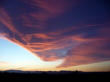
A third source of lift is wind circulation forcing air over a physical barrier such as a mountain (orographic lift).[14] If the air is generally stable, nothing more than lenticular cap clouds form. However, if the air becomes sufficiently moist and unstable, orographic showers or thunderstorms may appear.[21]
Clouds formed by any of these lifting agents are initially seen in the troposphere where these agents are most active. However, water vapor that has been lifted to the top of troposphere can be carried even higher by gravity waves where further condensation can result in the formation of clouds in the stratosphere and mesosphere. [22]
Non-adiabatic cooling
Along with adiabatic cooling that requires a lifting agent, three major nonadiabatic mechanisms exist for lowering the temperature of the air to its dew point. Conductive, radiational, and evaporative cooling require no lifting mechanism and can cause condensation at surface level resulting in the formation of fog.[23][24][25]
Adding moisture to the air
Several main sources of water vapor can be added to the air as a way of achieving saturation without any cooling process: evaporation from surface water or moist ground,[26][12][27] precipitation or virga,[28] and transpiration from plants.[29]
Tropospheric classification
Classification in the troposphere is based on a hierarchy of categories with physical forms and altitude levels at the top.[6][7] These are cross-classified into a total of ten genus types, most of which can be divided into species and further subdivided into varieties which are at the bottom of the hierarchy.[30]

Clouds in the troposphere assume five physical forms based on structure and process of formation. These forms are commonly used for the purpose of satellite analysis.[31] They are given below in approximate ascending order of instability or convective activity.[32]
- Nonconvective stratiform clouds appear in stable airmass conditions and, in general, have flat, sheet-like structures that can form at any altitude in the troposphere.[33] The stratiform group is divided by altitude range into the genera cirrostratus (high-level), altostratus (mid-level), stratus (low-level), and nimbostratus (multi-level).[7] Fog is commonly considered a surface-based cloud layer.[21] The fog may form at surface level in clear air or it may be the result of a very low stratus cloud subsiding to ground or sea level. Conversely, low stratiform clouds result when advection fog is lifted above surface level during breezy conditions.
- Cirriform clouds in the troposphere are of the genus cirrus and have the appearance of detached or semi-merged filaments. They form at high tropospheric altitudes in air that is mostly stable with little or no convective activity, although denser patches may occasionally show buildups caused by limited high-level convection where the air is partly unstable.[34] Clouds resembling cirrus, cirrostratus, and cirrocumulus can be found above the troposphere but are classified separately using common names.
- Stratocumuliform clouds both cumuliform and stratiform characteristics in the form of rolls, ripples, or elements.[5] They generally form as a result of limited convection in an otherwise mostly stable airmass topped by an inversion layer.[35] If the inversion layer is absent or higher in the troposphere, increased airmass instability may cause the cloud layers to develop tops in the form of turrets consisting of embedded cumuliform buildups.[36] The stratocumuliform group is divided into cirrocumulus (high-level, strato- prefix dropped), altocumulus (mid-level, strato- prefix dropped), and stratocumulus (low-level).[5]
- Cumuliform clouds generally appear in isolated heaps or tufts.[37][38] They are the product of localized but generally free-convective lift where no inversion layers are in the troposphere to limit vertical growth. In general, small cumuliform clouds tend to indicate comparatively weak instability. Larger cumuliform types are a sign of greater atmospheric instability and convective activity.[39] Depending on their vertical size, clouds of the cumulus genus type may be low-level or multi-level with moderate to towering vertical extent.[7]
- Cumulonimbus clouds are largest free-convective clouds, which has a towering vertical extent. They occur in highly unstable air[14] and often have fuzzy outlines at the upper parts of the clouds that sometimes include anvil tops.[5] These clouds are the product of very strong convection that can penetrate the lower stratosphere.
Levels and genera
Tropospheric clouds form in any of three levels (formerly called étages) based on altitude range above the Earth's surface. The grouping of clouds into levels is commonly done for the purposes of cloud atlases, surface weather observations,[7] and weather maps.[40] The base-height range for each level varies depending on the latitudinal geographical zone.[7] Each altitude level comprises two or three genus-types differentiated mainly by physical form.[41][5]
The standard levels and genus-types are summarised below in approximate descending order of the altitude at which each is normally based.[42] Multi-level clouds with significant vertical extent are separately listed and summarized in approximate ascending order of instability or convective activity.[32]
High-level

High clouds form at altitudes of 3,000 to 7,600 m (10,000 to 25,000 ft) in the polar regions, 5,000 to 12,200 m (16,500 to 40,000 ft) in the temperate regions, and 6,100 to 18,300 m (20,000 to 60,000 ft) in the tropics.[7] All cirriform clouds are classified as high, thus constitute a single genus cirrus (Ci). Stratocumuliform and stratiform clouds in the high altitude range carry the prefix cirro-, yielding the respective genus names cirrocumulus (Cc) and cirrostratus (Cs). If limited-resolution satellite images of high clouds are analyzed without supporting data from direct human observations, distinguishing between individual forms or genus types becomes impossible, and they are collectively identified as high-type (or informally as cirrus-type, though not all high clouds are of the cirrus form or genus).[43]
- Genus cirrus (Ci) – these are mostly fibrous wisps of delicate, white, cirriform, ice crystal clouds that show up clearly against the blue sky.[34] Cirrus are generally non-convective except castellanus and floccus subtypes which show limited convection. They often form along a high altitude jetstream[44] and at the very leading edge of a frontal or low-pressure disturbance where they may merge into cirrostratus. This high-level cloud genus does not produce precipitation.[42]
- Genus cirrocumulus (Cc) – this is a pure white high stratocumuliform layer of limited convection. It is composed of ice crystals or supercooled water droplets appearing as small unshaded round masses or flakes in groups or lines with ripples like sand on a beach.[45][46] Cirrocumulus occasionally forms alongside cirrus and may be accompanied or replaced by cirrostratus clouds near the leading edge of an active weather system. This genus-type occasionally produces virga, precipitation that evaporates below the base of the cloud.[19]
- Genus cirrostratus (Cs) – cirrostratus is a thin nonconvective stratiform ice crystal veil that typically gives rise to halos caused by refraction of the Sun's rays. The Sun and Moon are visible in clear outline.[47] Cirrostratus does not produce precipitation, but often thickens into altostratus ahead of a warm front or low-pressure area, which sometimes does.[48]
Mid-level
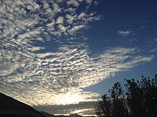
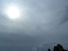
Nonvertical clouds in the middle level are prefixed by alto-, yielding the genus names altocumulus (Ac) for stratocumuliform types and altostratus (As) for stratiform types. These clouds can form as low as 2,000 m (6,500 ft) above surface at any latitude, but may be based as high as 4,000 m (13,000 ft) near the poles, 7,000 m (23,000 ft) at midlatitudes, and 7,600 m (25,000 ft) in the tropics.[7] As with high clouds, the main genus types are easily identified by the human eye, but distinguishing between them using satellite photography alone is not possible. When the supporting data of human observations are not available, these clouds are usually collectively identified as middle-type on satellite images.[43]
- Genus altocumulus (Ac) – This is a midlevel cloud layer of limited convection that is usually appears in the form of irregular patches or more extensive sheets arranged in groups, lines, or waves.[49] Altocumulus may occasionally resemble cirrocumulus, but is usually thicker and composed of a mix of water droplets and ice crystals, so the bases show at least some light-gray shading.[50] Altocumulus can produce virga, very light precipitation that evaporates before reaching the ground.[51]
- Genus altostratus (As) – Altostratus is a midlevel opaque or translucent nonconvective veil of gray/blue-gray cloud that often forms along warm fronts and around low-pressure areas. Altostratus is usually composed of water droplets, but may be mixed with ice crystals at higher altitudes. Widespread opaque altostratus can produce light continuous or intermittent precipitation.[52]
Low-level
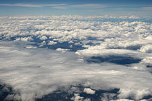
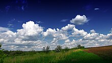
Low clouds are found from near the surface up to 2,000 m (6,500 ft).[7] Genus types in this level either have no prefix or carry one that refers to a characteristic other than altitude. Clouds that form in the low level of the troposphere are generally of larger structure than those that form in the middle and high levels, so they can usually be identified by their forms and genus types using satellite photography alone.[43]
- Genus stratocumulus (Sc) – This genus type is a stratocumuliform cloud layer of limited convection, usually in the form of irregular patches or more extensive sheets similar to altocumulus but having larger elements with deeper-gray shading.[53] Stratocumulus is often present during wet weather originating from other rain clouds, but can only produce very light precipitation on its own.[54]
- Species cumulus humilis – These are small detached fair-weather cumuliform clouds that have nearly horizontal bases and flattened tops, and do not produce rain showers.[55]
- Genus stratus (St) – This is a flat or sometimes ragged nonconvective stratiform type that sometimes resembles elevated fog.[56] Only very weak precipitation can fall from this cloud, usually drizzle or snow grains.[57][58] When a very low stratus cloud subsides to surface level, it loses its Latin terminology and is given the common name fog if the prevailing surface visibility is less than 1 km (0.62 mi).[59] If the visibility is 1 km or higher, the visible condensation is termed mist.[60]
Multi-level or moderate vertical
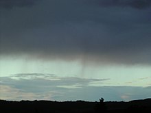
These clouds have low- to mid-level bases that form anywhere from near the surface to about 2,400 m (8,000 ft) and tops that can extend into the mid-altitude range and sometimes higher in the case of nimbostratus.
Zdroj:https://en.wikipedia.org?pojem=Sky_coverText je dostupný za podmienok Creative Commons Attribution/Share-Alike License 3.0 Unported; prípadne za ďalších podmienok. Podrobnejšie informácie nájdete na stránke Podmienky použitia.
Antropológia
Aplikované vedy
Bibliometria
Dejiny vedy
Encyklopédie
Filozofia vedy
Forenzné vedy
Humanitné vedy
Knižničná veda
Kryogenika
Kryptológia
Kulturológia
Literárna veda
Medzidisciplinárne oblasti
Metódy kvantitatívnej analýzy
Metavedy
Metodika
Text je dostupný za podmienok Creative
Commons Attribution/Share-Alike License 3.0 Unported; prípadne za ďalších
podmienok.
Podrobnejšie informácie nájdete na stránke Podmienky
použitia.
www.astronomia.sk | www.biologia.sk | www.botanika.sk | www.dejiny.sk | www.economy.sk | www.elektrotechnika.sk | www.estetika.sk | www.farmakologia.sk | www.filozofia.sk | Fyzika | www.futurologia.sk | www.genetika.sk | www.chemia.sk | www.lingvistika.sk | www.politologia.sk | www.psychologia.sk | www.sexuologia.sk | www.sociologia.sk | www.veda.sk I www.zoologia.sk
