
A | B | C | D | E | F | G | H | CH | I | J | K | L | M | N | O | P | Q | R | S | T | U | V | W | X | Y | Z | 0 | 1 | 2 | 3 | 4 | 5 | 6 | 7 | 8 | 9
The UNESCO (United Nations Educational, Scientific and Cultural Organization) has designated 37 World Heritage Sites in eight countries (also called "state parties") commonly referred to as Northern Europe: Iceland, Norway, Sweden, Finland, Denmark, Estonia, Latvia and Lithuania, i.e. a combination of Nordic and Baltic countries.[1] The Danish territory of the Faroe Islands doesn't have any sites. Greenland, lying on the North American continent, is not included in this list despite its political ties with Denmark; it is included in the List of World Heritage Sites in North America. The United Kingdom and Ireland are included in Western Europe even though they are sometimes listed in Northern Europe.[2]
Sweden is home to the most inscribed sites with 15 sites, two of which are transborder properties. Three sites are shared between several countries: the Curonian Spit (Lithuania and Russia), the High Coast / Kvarken Archipelago (Sweden and Finland) and the Struve Geodetic Arc (ten countries in Northern and Eastern Europe).[3] The first sites from the region were inscribed in 1979, when the Urnes Stave Church and Bryggen, both in Norway were chosen a year after the list's conception.[4][5] Each year, UNESCO's World Heritage Committee may inscribe new sites on the list, or delist sites that no longer meet the criteria. Selection is based on ten criteria: six for cultural heritage (i–vi) and four for natural heritage (vii–x).[6] Some sites, designated "mixed sites," represent both cultural and natural heritage. In Northern Europe, there are 32 cultural, 4 natural, and 1 mixed sites.[7]
The World Heritage Committee may also specify that a site is endangered, citing "conditions which threaten the very characteristics for which a property was inscribed on the World Heritage List." None of the sites in Northern Europe has ever been listed as endangered, though possible danger listing has been considered by UNESCO in a number of cases.[8][9]
Legend
- Site; named after the World Heritage Committee's official designation[3]
- Location; at city, regional, or provincial level and geocoordinates
- Criteria; as defined by the World Heritage Committee[6]
- Area; in hectares and acres. If available, the size of the buffer zone has been noted as well. A value of zero implies that no data has been published by UNESCO
- Year; during which the site was inscribed to the World Heritage List
- Description; brief information about the site, including reasons for qualifying as an endangered site, if applicable
World Heritage Sites
| Site | Image | Location | Criteria | Area ha (acre) |
Year | Description |
|---|---|---|---|---|---|---|
| Agricultural Landscape of Southern Öland | 
|
Kalmar, 56°19′30″N 16°29′00″E / 56.32500°N 16.48333°E |
Cultural: (iv), (v) |
56,323 (139,177); buffer zone 6,069 (14,997)
|
2000 | The southern part of the island of Öland in the Baltic Sea is dominated by a vast limestone plateau. Human beings have lived here for some five thousand years and adapted their way of life to the physical constraints of the island. As a consequence, the landscape is unique, with abundant evidence of continuous human settlement from prehistoric times to the present day. |
| Birka and Hovgården | 
|
Stockholm, 59°20′07″N 17°32′34″E / 59.33528°N 17.54278°E |
Cultural: (iii), (iv) |
—
|
1993 | The Birka archaeological site is located on Björkö Island in Lake Mälar and was occupied in the 9th and 10th centuries. Hovgården is situated on the neighbouring island of Adelsö. Together, they make up an archaeological complex which illustrates the elaborate trading networks of Viking-Age Europe and their influence on the subsequent history of Scandinavia. Birka was also important as the site of the first Christian congregation in Sweden, founded in 831 by St. Ansgar. |
| Bronze Age Burial Site of Sammallahdenmäki | 
|
Rauma (Lappi), Satakunta, 61°07′14″N 21°46′39″E / 61.12056°N 21.77750°E |
Cultural: (iii), (iv) |
—
|
1999 | This Bronze Age burial site features more than 30 granite burial cairns, providing a unique insight into the funerary practices and social and religious structures of northern Europe more than three millennia ago. |
| Bryggen | 
|
Bergen, Vestland, 60°23′50″N 05°19′23″E / 60.39722°N 5.32306°E |
Cultural: (iii) |
—
|
1979 | Bryggen, the old wharf of Bergen, is a reminder of the town's importance as part of the Hanseatic League's trading empire from the 14th to the mid-16th century. Many fires, the last in 1955, have ravaged the characteristic wooden houses of Bryggen. Its rebuilding has traditionally followed old patterns and methods, thus leaving its main structure preserved, which is a relic of an ancient wooden urban structure once common in Northern Europe. Today, some 62 buildings remain of this former townscape. |
| Christiansfeld, a Moravian Church Settlement | 
|
Christiansfeld, Kolding Municipality, Southern Denmark, 55°21′20″N 09°28′53″E / 55.35556°N 9.48139°E |
Cultural: (iii), (iv) |
—
|
2015 | Founded in 1773 in South Jutland, the site is an example of a planned settlement of the Moravian Church, a Lutheran free congregation centred in Herrnhut, Saxony. The town was planned to represent the Protestant urban ideal, constructed around a central Church square. The architecture is homogenous and unadorned, with one and two-storey buildings in yellow brick with red tile roofs. The democratic organization of the Moravian Church, with its pioneering egalitarian philosophy, is expressed in its humanistic town planning. The settlement's plan opens onto agricultural land and includes important buildings for the common welfare such as large communal houses for the congregation's widows and unmarried men and women. The buildings are still in use and many are still owned by the local Moravian Church community . |
| Church Village of Gammelstad, Luleå | 
|
Norrbotten, 65°38′46″N 22°1′43″E / 65.64611°N 22.02861°E |
Cultural: (ii), (iv), (v) |
—
|
1996 | Gammelstad, at the head of the Gulf of Bothnia, is the best-preserved example of a 'church village', a unique kind of village formerly found throughout northern Scandinavia. The 424 wooden houses, huddled round the early 15th-century stone church, were used only on Sundays and at religious festivals to house worshippers from the surrounding countryside who could not return home the same day because of the distance and difficult travelling conditions. |
| Curonian Spit | 
|
Neringa and Klaipėda district, Klaipėda County, 55°16′28″N 20°57′45″E / 55.27444°N 20.96250°E |
Cultural: (v) |
—
|
2000 | Human habitation of this elongated sand dune peninsula, 98 km long and 0.4–4 km wide, dates back to prehistoric times. Throughout this period it has been threatened by the natural forces of wind and waves. Its survival to the present day has been made possible only as a result of ceaseless human efforts to combat the erosion of the Spit, dramatically illustrated by continuing stabilisation and reforestation projects. |
| Decorated Farmhouses of Hälsingland | 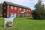
|
Gävleborg, 61°42′26″N 16°11′45″E / 61.70722°N 16.19583°E |
Cultural: (v) |
14 (35); buffer zone 537 (1,330) | 2012 | Seven timber houses are listed in this site located in the east of Sweden, representing the zenith of a regional timber building tradition that dates back to the Middle Ages. They reflect the prosperity of independent farmers who in the 19th century used their wealth to build substantial new homes with elaborately decorated ancillary houses or suites of rooms reserved for festivities. The paintings represent a fusion of folk art with the styles favored by the landed gentry of the time, including Baroque and Rococo. Decorated by painters, including known and unknown itinerant artists, the listed properties represent the final flowering of a long cultural tradition. |
| Engelsberg Ironworks | 
|
Västmanland, 59°58′00″N 16°00′30″E / 59.96667°N 16.00833°E |
Cultural: (iv) |
—
|
1993 | Sweden's production of superior grades of iron made it a leader in this field in the 17th and 18th centuries. This site is the best-preserved and most complete example of this type of Swedish ironworks. |
| Fortress of Suomenlinna | 
|
Helsinki, 60°8′50″N 24°59′14″E / 60.14722°N 24.98722°E |
Cultural: (iv) |
—
|
1991 | Built in the second half of the 18th century by Sweden on a group of islands located at the entrance of Helsinki's harbour, this fortress is an especially interesting example of European military architecture of the time. |
| Hanseatic Town of Visby | 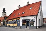
|
Gotland, 57°38′30″N 18°17′45″E / 57.64167°N 18.29583°E |
Cultural: (iv), (v) |
—
|
1995 | A former Viking site on the island of Gotland, Visby was the main centre of the Hanseatic League in the Baltic from the 12th to the 14th century. Its 13th-century ramparts and more than 200 warehouses and wealthy merchants' dwellings from the same period make it the best-preserved fortified commercial city in northern Europe. |
| High Coast / Kvarken Archipelago | 
|
Västernorrland, 63°18′00″N 21°18′00″E / 63.30000°N 21.30000°E |
Natural: (viii) |
194,400 (480,000) | 2000[nb 1] | The Kvarken Archipelago (Finland) and the High Coast (Sweden) are situated in the Gulf of Bothnia, a northern extension of the Baltic Sea. The 5,600 islands of the Kvarken Archipelago feature unusual ridged washboard moraines, ‘De Geer moraines’, formed by the melting of the continental ice sheet, 10,000 to 24,000 years ago. The Archipelago is continuously rising from the sea in a process of rapid glacio-isostatic uplift, whereby the land, previously weighed down under the weight of a glacier, lifts at rates that are among the highest in the world. As a consequence islands appear and unite, peninsulas expand, and lakes evolve from bays and develop into marshes and peat fens. The High Coast has also been largely shaped by the combined processes of glaciation, glacial retreat and the emergence of new land from the sea. Since the last retreat of the ice from the High Coast 9,600 years ago, the uplift has been in the order of 285 m which is the highest known ''rebound''. The site affords outstanding opportunities for the understanding of the important processes that formed the glaciated and land uplift areas of the Earth's surface. |
| Historic Centre of Riga | Riga, 56°57′15″N 24°07′00″E / 56.95417°N 24.11667°E |
Cultural: (i), (ii) |
438 (1,080); buffer zone 1,574 (3,890) | 1997 | Riga was a major centre of the Hanseatic League, deriving its prosperity in the 13th–15th centuries from the trade with central and eastern Europe. The urban fabric of its medieval centre reflects this prosperity, though most of the earliest buildings were destroyed by fire or war. Riga became an important economic centre in the 19th century, when the suburbs surrounding the medieval town were laid out, first with imposing wooden buildings in neoclassical style and then in Jugendstil . It is generally recognized that Riga has the finest collection of art nouveau buildings in Europe. | |
| Historic Centre (Old Town) of Tallinn | 
|
Tallinn, Harju County, 59°26′00″N 24°44′00″E / 59.43333°N 24.73333°E |
Cultural: (ii), (iv) |
113 (280); buffer zone 2,253 (5,570) | 1997[nb 2] | The origins of Tallinn date back to the 13th century, when a castle was built there by the crusading knights of the Teutonic Order. It developed as a major centre of the Hanseatic League, and its wealth is demonstrated by the opulence of the public buildings (the churches in particular) and the domestic architecture of the merchants' houses, which have survived to a remarkable degree despite the ravages of fire and war in the intervening centuries. |
| Jelling Mounds, Runic Stones and Church | 
|
Jelling, Vejle Municipality, Southern Denmark, 55°45′23″N 9°25′12″E / 55.75639°N 9.42000°E |
Cultural: (iii) |
4.96 (12.3) | 1994 | The Jelling burial mounds and one of the runic stones are striking examples of pagan Nordic culture, while the other runic stone and the church illustrate the Christianization of the Danish people towards the middle of the 10th century. |
| Kernavė Archaeological Site (Cultural Reserve of Kernavė) | 
|
Kernavė, Širvintos district, Vilnius County, 54°53′16″N 24°49′50″E / 54.88778°N 24.83056°E |
Cultural: (iii), (iv) |
194 (480); buffer zone 2,455 (6,070) | 2004 | The Kernavė Archaeological site, about 35 km north-west of Vilnius in eastern Lithuania, represents an exceptional testimony to some 10 millennia of human settlements in this region. Situated in the valley of the River Neris, the site is a complex ensemble of archaeological properties, encompassing the town of Kernavė, forts, some unfortified settlements, burial sites and other archaeological, historical and cultural monuments from the late Palaeolithic Period to the Middle Ages. The site of 194,4 ha has preserved the traces of ancient land-use, as well as remains of five impressive hill forts, part of an exceptionally large defence system. Kernavė was an important feudal town in the Middle Ages. The town was destroyed by the Teutonic Order in the late 14th century, however the site remained in use until modern times. |
| Kronborg Castle | 
|
Helsingør, Capital Region, Zealand, 56°2′20″N 12°37′15″E / 56.03889°N 12.62083°E |
Cultural: (iv) |
—
|
2000 | Located on a strategically important site commanding the Sund, the stretch of water between Denmark and Sweden, the Royal castle of Kronborg at Helsingør (Elsinore) is of immense symbolic value to the Danish people and played a key role in the history of northern Europe in the 16th-18th centuries. Work began on the construction of this outstanding Renaissance castle in 1574, and its defences were reinforced according to the canons of the period's military architecture in the late 17th century. It has remained intact to the present day. It is world-renowned as Elsinore, the setting of Shakespeare's Hamlet. |
| Laponian Area | 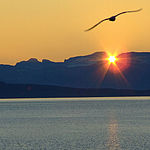
|
Norrbotten, 67°20′00″N 17°35′00″E / 67.33333°N 17.58333°E |
Mixed: (iii), (v), (vii), (viii), (ix) |
940,000 (2,300,000) | 1996 | The Arctic Circle region of northern Sweden is the home of the Saami, or Lapp people. It is the largest area in the world (and one of the last) with an ancestral way of life based on the seasonal movement of livestock. Every summer, the Saami lead their huge herds of reindeer towards the mountains through a natural landscape hitherto preserved, but now threatened by the advent of motor vehicles. Historical and ongoing geological processes can be seen in the glacial moraines and changing water courses. |
| Mining Area of the Great Copper Mountain in Falun | 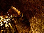
|
Dalarna, 60°36′17″N 15°37′51″E / 60.60472°N 15.63083°E |
Cultural: (ii), (iii), (v) |
43 (110); buffer zone 3,500 (8,600) | 2001 | The enormous mining excavation known as the Great Pit at Falun is the most striking feature of a landscape that illustrates the activity of copper production in this region since at least the 13th century. The 17th-century planned town of Falun with its many fine historic buildings, together with the industrial and domestic remains of a number of settlements spread over a wide area of the Dalarna region, provide a vivid picture of what was for centuries one of the world's most important mining areas. |
| Naval Port of Karlskrona | 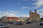
|
Blekinge, 56°10′00″N 15°35′00″E / 56.16667°N 15.58333°E |
Cultural: (ii), (iv) |
—
|
1998 | Karlskrona is an outstanding example of a late-17th-century European planned naval city. The original plan and many of the buildings have survived intact, along with installations that illustrate its subsequent development up to the present day. |
| Old Rauma | 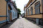
|
Rauma, Satakunta, 61°7′41″N 21°30′42″E / 61.12806°N 21.51167°E |
Cultural: (iv), (v) |
29 (72); buffer zone 142 (350) | 1991[nb 3] | Situated on the Gulf of Botnia, Rauma is one of the oldest harbours in Finland. Built around a Franciscan monastery, where the mid-15th-century Holy Cross Church still stands, it is an outstanding example of an old Nordic city constructed in wood. Although ravaged by fire in the late 17th century, it has preserved its ancient vernacular architectural heritage. |
| The par force hunting landscape in North Zealand | 
|
Capital Region, Zealand, 55°54′49″N 12°21′28″E / 55.91361°N 12.35778°E |
Cultural: (ii), (iv) |
—
|
2015 | Located about 30 km northwest of Copenhagen, this cultural landscape encompasses the two hunting forests of Store Dyrehave and Gribskov, as well as the hunting park of Jægersborg Hegn/Jægersborg Dyrehave. This is a designed landscape where Danish kings and their court practiced par force hunting, or hunting with hounds, which reached its peak between the 17th and the late 18th centuries, when the absolute monarchs transformed it into a landscape of power. With hunting lanes laid out in a star system, combined with an orthogonal grid pattern, numbered stone posts, fences and a hunting lodge, the site demonstrates the application of Baroque landscaping principles to forested areas. |
| Petäjävesi Old Church | 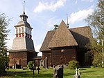
|
Petäjävesi, Central Finland, 62°15′00″N 25°11′00″E / 62.25000°N 25.18333°E |
Cultural: (iv) |
—
|
1994 | Petäjävesi Old Church, in central Finland, was built of logs between 1763 and 1765. This Lutheran country church is a typical example of an architectural tradition that is unique to eastern Scandinavia. It combines the Renaissance conception of a centrally planned church with older forms deriving from Gothic groin vaults. |
| Rjukan–Notodden Industrial Heritage Site | 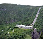
|
Notodden Municipality / Rjukan, Telemark, 59°52′43″N 8°35′37″E / 59.87861°N 8.59361°E Denmark (7)
Estonia (3)
Finland (7)
Iceland (7)
Latvia (3)
Lithuania (2)
Norway (5)
Sweden (1)
Notesedit
Analytika
Antropológia Aplikované vedy Bibliometria Dejiny vedy Encyklopédie Filozofia vedy Forenzné vedy Humanitné vedy Knižničná veda Kryogenika Kryptológia Kulturológia Literárna veda Medzidisciplinárne oblasti Metódy kvantitatívnej analýzy Metavedy Metodika Text je dostupný za podmienok Creative
Commons Attribution/Share-Alike License 3.0 Unported; prípadne za ďalších
podmienok. www.astronomia.sk | www.biologia.sk | www.botanika.sk | www.dejiny.sk | www.economy.sk | www.elektrotechnika.sk | www.estetika.sk | www.farmakologia.sk | www.filozofia.sk | Fyzika | www.futurologia.sk | www.genetika.sk | www.chemia.sk | www.lingvistika.sk | www.politologia.sk | www.psychologia.sk | www.sexuologia.sk | www.sociologia.sk | www.veda.sk I www.zoologia.sk |

