A | B | C | D | E | F | G | H | CH | I | J | K | L | M | N | O | P | Q | R | S | T | U | V | W | X | Y | Z | 0 | 1 | 2 | 3 | 4 | 5 | 6 | 7 | 8 | 9
Gyumri
Գյումրի | |
|---|---|
City and urban community | |
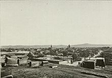
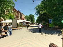
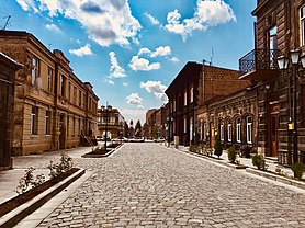
From top down, left to right; Abovyan street view • City Hall • Cathedral of Gyumri • Dzitoghtsyan Museum of National Architecture • Independence Square • Gyumri skyline | |
| Nickname: Hayrakaghak ("Father-city") | |
| Coordinates: 40°47′22″N 43°50′51″E / 40.78944°N 43.84750°E | |
| Country | Armenia |
| Province | Shirak |
| Founded as Kumayri by the Urartians | 8th century BC |
| Rebuilt as Alexandropol by Nicholas I of Russia | 1837 |
| Government | |
| • Type | Mayor–council |
| • Mayor | Samvel Balasanyan |
| Area | |
| • Total | 54 km2 (21 sq mi) |
| Elevation | 1,509 m (4,951 ft) |
| Population (2011 census) | |
| • Total | 121,976 |
| • Estimate (1 October 2019) | 112,600[1] |
| • Density | 2,300/km2 (5,900/sq mi) |
| Demonym | Gyumretsi |
| Time zone | UTC+4 (AMT) |
| Postal code | 3101-3126 |
| Area code | (+374) 312 |
| Vehicle registration | 45 am |
| Climate | Dfb |
| Website | www |
| Sources: Population[2] | |
Gyumri (Armenian: Գյումրի,[a] pronounced [ɡjumˈɾi]) is an urban municipal community and the second-largest city in Armenia, serving as the administrative center of Shirak Province in the northwestern part of the country. By the end of the 19th century, when the city was known as Alexandropol,[b] it became the largest city of Russian-ruled Eastern Armenia with a population above that of Yerevan. The city became renowned as a cultural hub, while also carrying significance as a major center of Russian troops during Russo-Turkish wars of the 19th century.
The city underwent a tumultuous period during and after World War I. While Russian forces withdrew from the South Caucasus due to the October Revolution, the city became host to large numbers of Armenian refugees fleeing the Armenian Genocide, in particular hosting 22,000 orphaned children in around 170 orphanage buildings. It was renamed Leninakan[c] during the Soviet period and became a major industrial and textile center in Soviet Armenia.[3] The city's population rapidly grew to above 200,000 prior to the 1988 Spitak earthquake, when it was devastated, with the city's population being reduced to 121,976 as of the 2011 census. The city was renamed Gyumri under modern independent Armenia soon after the breakup of the Soviet Union, and post-earthquake reconstruction efforts continue.
Today, Gyumri continues to grapple with the lasting effects of the 1988 earthquake, but remains known as the cultural hub of Armenia due to the many artists and craftsman who originated from the city. The city is also in particular notable for the large Kumayri historic district that managed to mostly survive the 1988 earthquake, dating back mainly to the 19th century and being one of the few surviving places in the world with authentic urban Armenian architecture.[3]
Name
The area of modern-day Gyumri was originally known as Kumayri (Armenian: Կումայրի) during the period of the Kingdom of Urartu. Over time, the name became disrupted through phonetic changes to Kumri, then Gumri, and finally Gyumri. In 1837, Gyumri was renamed Alexandropol after Czar Nicholas I's wife, Princess Alexandra Fyodorovna. Between 1924 and 1990, the city was known as Leninakan in honor of Vladimir Lenin. Following independence, the original name Kumayri was used until 1992, when Gyumri was chosen as the name of the city.[4][3]
History
Classical antiquity and the ancient Armenian Kingdom

Archaeological excavations conducted throughout the Soviet period have shown that the area of modern-day Gyumri has been populated since at least the third millennium BC. The area was mentioned as Kumayri in the historic Urartian inscriptions dating back to the 8th century BC.[5] Kumayri may be identical with the city of Gymnias or Gumnias mentioned by Xenophon in his Anabasis.[6]
At the decline of the Urartu Kingdom by the second half of the 6th century BC, Kumayri became part of the Achaemenid Empire. The remains of a royal settlement found just to the south of Gyumri near the village of Beniamin dating back to the 5th to 2nd centuries BC, are a great example of the Achemenid influence in the region. However, at the beginning of the 5th century BC, Kumayri became part of the Satrapy of Armenia under the rule of the Orontids. An alternative theory suggests that Kumayri has been formed as an urban settlement in the late 5th century BC, ca. 401 BC, by Greek colonists.[7]
Later in 331 BC, the entire territory was included in the Ayrarat province of Ancient Armenian Kingdom as part of the Shirak canton. Between 190 BC and 1 AD Kumayri was under the rule of the Artaxiad dynasty of Armenia. During the 1st century AD, Shirak was granted to the Kamsarakan family, who ruled over Kumayri during the Arsacid Kingdom of Armenia.[8]
Medieval period
Following the partition of Armenia in 387 between the Byzantines and the Persians, and as a result of the fall of the Arsacid Kingdom of Armenia in 428, Shirak including Kumayri became part of the Sasanian Empire of Persia. In 658 AD, at the height of the Arab Islamic invasions, Kumayri was conquered during the Muslim conquest of Persia to become part of the Emirate of Armenia under the Umayyad Caliphate.[9]
Kumayri was a significant and quite-developed urban settlement during the Middle Ages. According to the Armenian scholar Ghevond the Historian, the town was a center of the Armenian rebellion led by Artavazd Mamikonian against the Islamic Arab Caliphate, between 733 and 755. After 2 centuries of Islamic rule over Armenia, the Bagratids declared independence in 885 establishing the Bagratid Kingdom of Armenia.[10][11] Kumayri entered e new era of growth and progress, particularly when the nearby city of Ani became the capital of the kingdom in 961. By the second half of the 10th century, Kumayri was under the influence of the Armenian Pahlavuni family, who were descendants of the Kamsarakans. The Pahlavunis had a great contribution in the progress of Shirak with the foundation of many fortresses, monastic complexes, educational institutions, etc.[12][13]

After the fall of Armenia to the Byzantine Empire in 1045 and later to the Seljuk invaders in 1064. Under the foreign rulers, the town had gradually lost its significance during the following centuries, until the establishment of the Zakarid Principality of Armenia in 1201 under the Georgian protectorate. During the Zakarid rule, the Eastern Armenian territories, mainly Lori and Shirak, entered into a new period of growth and stability, becoming a trade center between the east and the west. After the Mongols captured Ani in 1236, Armenia turned into a Mongol protectorate as part of the Ilkhanate, and the Zakarids became vassals to the Mongols. After the fall of the Ilkhanate in the mid-14th century, the Zakarid princes ruled over Lori, Shirak, and Ararat plain until 1360 when they fell to the invading Turkic tribes.[14]
By the last quarter of the 14th century, the Ag Qoyunlu Sunni Oghuz Turkic tribe took over Armenia, including Shirak. In 1400, Timur invaded Armenia and Georgia, and captured more than 60,000 of the survived local people as slaves. Many districts including Shirak were depopulated.[14] In 1410, Armenia fell under the control of the Kara Koyunlu Shia Oghuz Turkic tribe. According to the Armenian historian Thomas of Metsoph, although the Kara Koyunlu levied heavy taxes against the Armenians, the early years of their rule were relatively peaceful and some reconstruction of towns took place.[15]
Persian and Russian rules

In 1501, most of the Eastern Armenian territories including Kumayri were conquered by the emerging Safavid dynasty of Iran led by Shah Ismail I.[16] Soon after in 1502, Kumayri became part of the newly formed Erivan Beglarbegi, a new administrative territory of Iran formed by the Safavids. During the first half of the 18th century, Kumayri became part of the Erivan Khanate under the rule of the Afsharid dynasty and later under the Qajar dynasty of Persia.

In June 1804, the Russian forces controlled over Shirak region at the beginning of the Russo-Persian War of 1804 and 1813. Kumayri became officially part of the Russian Empire at the Treaty of Gulistan signed on 1 January 1813 between Imperial Russia and Qajar Persia.
During the period of Russian rule, Gyumri became one of the developing cities in the Transcaucasus. In 1829, in the aftermath of the Russo-Turkish War, there was a big influx of Armenian population, as around 3,000 families who had migrated from territories in the Ottoman Empire -in particular from the towns of Kars, Erzurum, and Doğubeyazıt- settled in and around Gyumri. The Russian poet Alexander Pushkin visited Gyumri during his journey to Erzurum in 1829.

In 1837 Russian Tsar Nicholas I arrived in Gyumri and changed the name into Alexandropol. The name was chosen in honour of Tsar Nicholas I's wife, Princess Charlotte of Prussia, who had changed her name to Alexandra Fyodorovna after converting to Orthodox Christianity.
A major Russian fortress was built on the site in 1837. Alexandropol was finally formed as a town in 1840 to become the center of the newly established Alexandropol Uyezd, experiencing rapid growth during its first decade. In 1849, the Alexandropol Uyezd became part of the Erivan Governorate. The town was an important outpost for the Imperial Russian armed forces in the Transcaucasus where their military barracks were established (e.g., at Poligons, Severski, Kazachi Post). The Russians built the Sev Berd fortress at the western edge of the city during the 1830s in response to the Russo-Turkish War of 1828–1829.
Alexandropol had been quickly transformed to become one of the major centers of the Russian troops during the Russo-Turkish War of 1877–78. After the establishment of the railway station in 1899, Alexandropol witnessed significant growth and became the largest city in Eastern Armenia. By the end of the 19th century, Alexandropol was home to 430 shopping stores, several workshops, cultural institutions, a girl's gymnasium, a commercial school, a theater, and leather, bear, and soap enterprises.[17]
Modern history

In 1902, the first bank in the city was opened. Until the sovietization of Armenia in 1920, Alexandropol had 31 manufacturing centers including beer, soap, textile, etc. After the October Revolution of 1917 and the Russian withdrawal from the South Caucasus, the Ottoman forces launched a new offensive capturing the city of Alexandropol on 11 May 1918, during the Caucasus Campaign in World War I. However, the Ottomans withdrew from the city on 24 December 1918, as stipulated by the Armistice of Mudros.[citation needed] On 6 December 1918, the Armenian army reoccupied the city.[18]
The newly established Republic of Armenia proclaimed on 28 May 1918, included the city of Alexandropol. On 10 May 1920, the local Bolshevik Armenians aided by the Muslim population, attempted a coup d'état in Alexandropol against the Dashnak government of Armenia. The uprising was suppressed by the Armenian government on May 14 and its leaders were executed. However, during another Turkish invasion, Turkish troops attacked Alexandropol and occupied the city on 7 November 1920. Armenia was forced to sign the Treaty of Alexandropol on December 3 to stop the Turkish advance towards Yerevan, however a concurrent Soviet invasion led to the fall of the Armenian government on December 2. The Turkish forces withdrew from Alexandropol after the Treaty of Kars was signed in October 1921 by the unrecognized Soviet and Turkish governments.[19]

Under Soviet rule, the name of the city was changed in 1924 to Leninakan after the deceased Soviet leader Vladimir Lenin. The city suffered an earthquake in 1926, when many of its significant buildings were destroyed including the Greek church of Saint George.
Leninakan became a major industrial center in the Armenian Soviet Socialist Republic and its second-largest city, after the capital Yerevan. The city suffered major damage during the 1988 Armenian earthquake, which devastated many parts of the country. The earthquake occurred along a known thrust fault with a length of 60 kilometers (37 mi). Its strike was parallel to the Caucasus range and dipped to the north-northeast. Bruce Bolt, a seismologist and a professor of earth and planetary science at the University of California, Berkeley, walked the fault scarp in 1992 and found that the vertical displacement measured 1 m (3 ft 3 in) along most of the length with the southwest end reaching 1.6 m (5 ft 3 in).[20]
The earthquake had a disastrous impact on the city, as many buildings are still not recovered. As of 2014[update], according to some news websites, between 4,000 and 5,000 residents of Gyumri remain homeless, although there are no official figures provided by the local authorities of the city.[21]

At the time of the breakup of the Soviet Union, the city was renamed Kumayri between in 1990 until 1992 when it was finally given the name Gyumri. The Russian 102nd Military Base is located in the city.[22]
Gyumri was celebrated as the Capital of Culture of the Commonwealth of Independent States for 2013. Major events took place in the city on 30 June 2013.[23]
On 12 January 2015, Valery Permyakov, a serviceman from the Russian 102nd Military Base, murdered seven members of an Armenian family in Gyumri.[24]
On 25 June 2016, Pope Francis delivered a Holy Mass at Gyumri's Vartanants Square. Catholicos of All Armenians Garegin II also took part in the ceremony.[25]
Geography and climate

Gyumri is 126 kilometres (78 miles) north of the capital Yerevan at the central part of the Shirak plateau. It has an approximate height of 1,550 metres (5,090 feet) above sea level, the high altitude line being 1,500 metres (4,900 feet). The Akhurian River passes through the western suburbs. The Shirak plateau is surrounded with the Pambak Mountains from the east and Aragats volcanic range from the south. The city of Gyumri is 196 kilometres (122 miles) away from the Black Sea. The surrounding lands near the city are rich in tufa, basalt and clay.[citation needed]
Gyumri has a humid continental climate (Köppen Dfb), characterized by freezing and snowy winters and warm summers. The annual precipitation averages 510 millimetres or 20.08 inches.
| Climate data for Gyumri, 1,523 metres (5,000 ft) asl (1991-2020 normals) | |||||||||||||
|---|---|---|---|---|---|---|---|---|---|---|---|---|---|
| Month | Jan | Feb | Mar | Apr | May | Jun | Jul | Aug | Sep | Oct | Nov | Dec | Year |
| Record high °C (°F) | 10.4 (50.7) |
14.0 (57.2) |
21.5 (70.7) |
32.4 (90.3) |
32.9 (91.2) |
33.5 (92.3) |
38.0 (100.4) |
38.2 (100.8) |
35.8 (96.4) |
30.3 (86.5) |
22.9 (73.2) |
17.6 (63.7) |
38.2 (100.8) |
| Mean daily maximum °C (°F) | −2.7 (27.1) |
−1.5 (29.3) |
4.6 (40.3) |
14.0 (57.2) |
17.9 (64.2) |
22.8 (73.0) |
27.1 (80.8) |
26.7 (80.1) |
24.0 (75.2) |
15.7 (60.3) |
7.2 (45.0) |
−0.2 (31.6) |
13.0 (55.3) |
| Daily mean °C (°F) | −8.2 (17.2) |
−6.8 (19.8) |
−0.8 (30.6) |
7.4 (45.3) |
11.4 (52.5) |
15.9 (60.6) |
20.1 (68.2) |
19.4 (66.9) |
15.8 (60.4) |
8.7 (47.7) |
2.0 (35.6) |
−4.8 (23.4) |
6.7 (44.0) |
| Mean daily minimum °C (°F) | −13.6 (7.5) |
−12 (10) |
−6.2 (20.8) |
0.8 (33.4) |
5.0 (41.0) |
8.9 (48.0) |
12.9 (55.2) |
12.1 (53.8) |
7.5 (45.5) |
1.6 (34.9) |
−3.2 (26.2) |
−9.3 (15.3) |
0.4 (32.6) |
| Record low °C (°F) | −41 (−42) |
−35 (−31) |
−30.1 (−22.2) |
−16 (3) |
−7.6 (18.3) |
−3.6 (25.5) |
0.3 (32.5) |
−1.1 (30.0) |
−4.1 (24.6) |
−14.6 (5.7) |
−23.8 (−10.8) |
−31.2 (−24.2) |
−41 (−42) |
| Average precipitation mm (inches) | 23.4 (0.92) |
20.9 (0.82) |
32.7 (1.29) |
61.8 (2.43) |
89.1 (3.51) |
66.8 (2.63) |
52.1 (2.05) |
38.3 (1.51) |
30.0 (1.18) |
42.6 (1.68) |
28.1 (1.11) |
24.6 (0.97) |
510.4 (20.1) |
| Average precipitation days (≥ 1.0 mm) | 5.5 | 5.1 | 7.1 | 10.7 | 13.4 | 10 | 7.1 | 6.2 | 5.2 | 6.3 | 4.9 | 6 | 87.5 |
| Average relative humidity (%) | 83.3 | 80.4 | 73.1 | 67.9 | 68.8 | 65 | 62.4 | 59.6 | 61.3 | 68.6 | 74.7 | 82.6 | 70.6 |
| Mean monthly sunshine hours | 98.4 | 112 | 146.9 | 155.4 | 208.1 | 293.6 | 344.6 | 319 | 271.5 | 196.4 | 148.4 | 100.7 | 2,395 |
| Source 1: NOAA[26] Météo climat stats[27][28] | |||||||||||||
| Source 2: Climatebase.ru[29] | |||||||||||||
Demographics
Population
The population of Gyumri has gradually grown since 1840 after gaining the status of town. A huge decline of the population was due to the disastrous earthquake of 1988. The dialect of Gyumri is a variant of Karin dialect, closely related to Western Armenian, as many Armenian genocide survivors migrated to Alexandropol.[30]


